

Isaias made landfall as a strong Category 2 Hurricane Friday night around 9:30 pm Eastern/8:30pm Central near Destin, Florida.
As Isaias moved inland, drier air arriving from the south allowed for rapid weakening of the storm.
The animation below illustrates the water vapor satellite imagery. An upper level jet stream is feeding dry air (yellow) into the remnants of Isaias (darker blue, white and green).

Rainfall Recap
However, tropical rainbands moved north through Metro Atlanta, and one slow-moving rainband prompted a Flash Flood Warning for portions of Clayton, DeKalb, Fulton, Gwinnett, Henry and Rockdale counties.
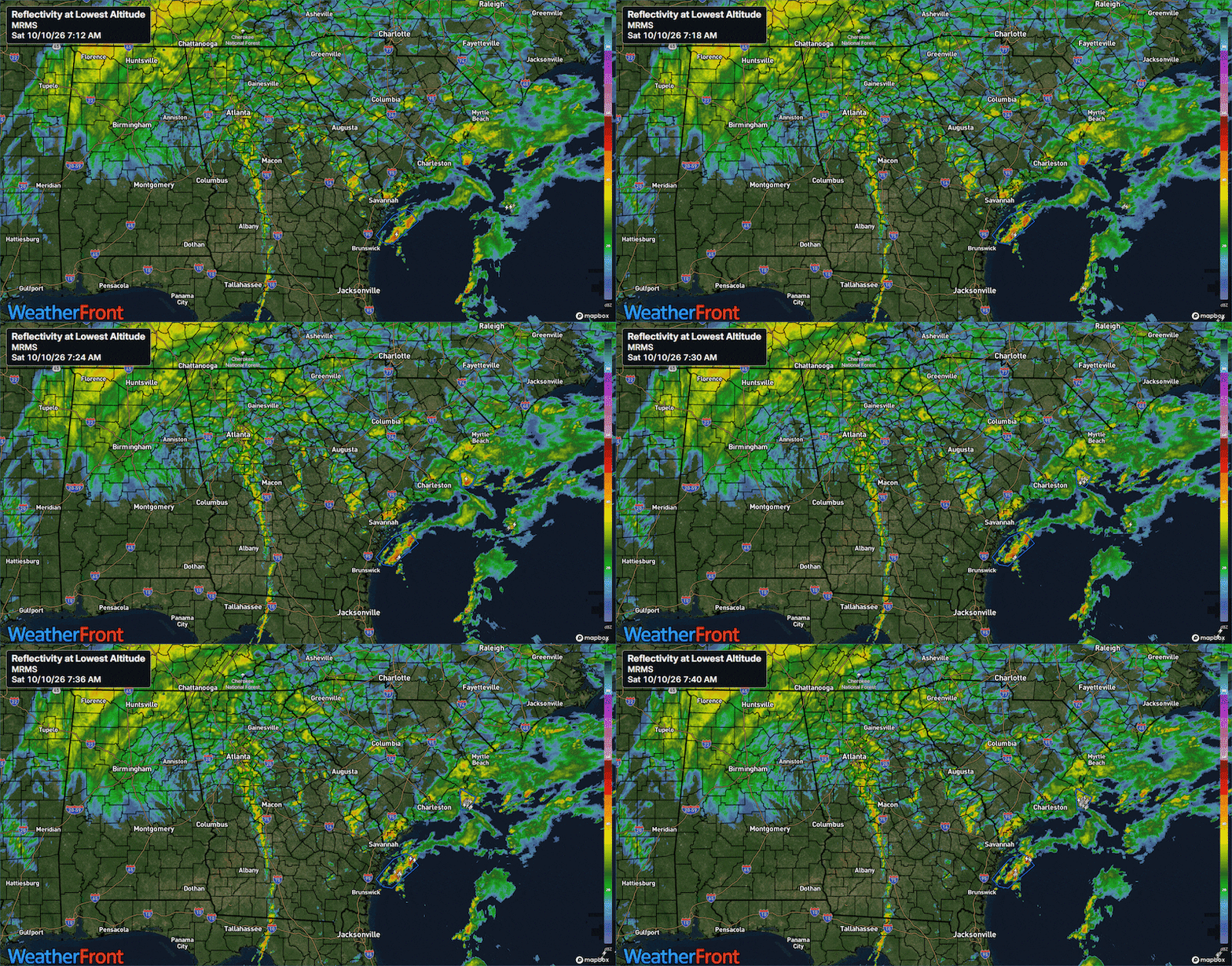
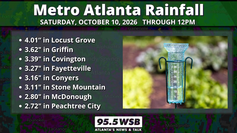
East and southeast Metro Atlanta areas were hit particularly hard with rain this morning, with 3 to 4 inches of rain reported throughout Rockdale, Henry, and Spalding counties.

Below is a recap of rainfall totals from around the Metro Atlanta area:
- 4.01″ in Locust Grove
- 3.62″ in Griffin
- 3.39″ in Covington
- 3.27″ in Fayetteville
- 3.16″ in Conyers
- 3.11″ in Stone Mountain
- 2.80″ in McDonough
- 2.72″ in Peachtree City
Wind Gusts Recap
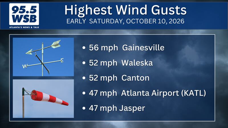
The strong winds in Metro Atlanta and North Georgia were indirectly due to Isaias. A combination of an upper level jet stream as well as a pressure gradient between Isaias and a surface high in New England generated strong wind gusts just before daybreak and through the morning.
Here are the highest wind gusts observed through 10am Saturday:
- 52 mph near Waleska
- 47 mph at the Atlanta Airport
- 47 mph in Gainesville
- 47 mph in Jasper
- 46 mph in Canton
- 45 mph in Cumming
Wind gusts this strong and for this long of duration were capable of knocking down numerous trees and powerlines throughout Cherokee and Pickens counties.
Additional tree-down reports include the cities of Smyrna and Brookhaven.
Tropical Tornado Threat?
When a tropical system -- like a tropical storm or hurricane -- makes landfall along the Florida coast, the rainbands from the tropical system have the potential to produce quick-spin up tornadoes within them.
Eastern Georgia -- including Waynesboro and Augusta -- remained in the 70s, and thunderstorms have produced tornadoes near the Georgia/South Carolina state line.
However, the “Wedge” kept Metro Atlanta shrouded in cool cloud cover, and afternoon temperatures remained in the low to mid 60s as far south as the Atlanta Airport.
Newnan, Hampton, and Covington warmed into the low 70s, but with the east wind and cloud cover in place, the tornado threat for this area of the southeast Metro region remained low.
Connect with Me!
Facebook: Christina Edwards WSB
Instagram: ChristinaWSBwx
©2026 Cox Media Group