
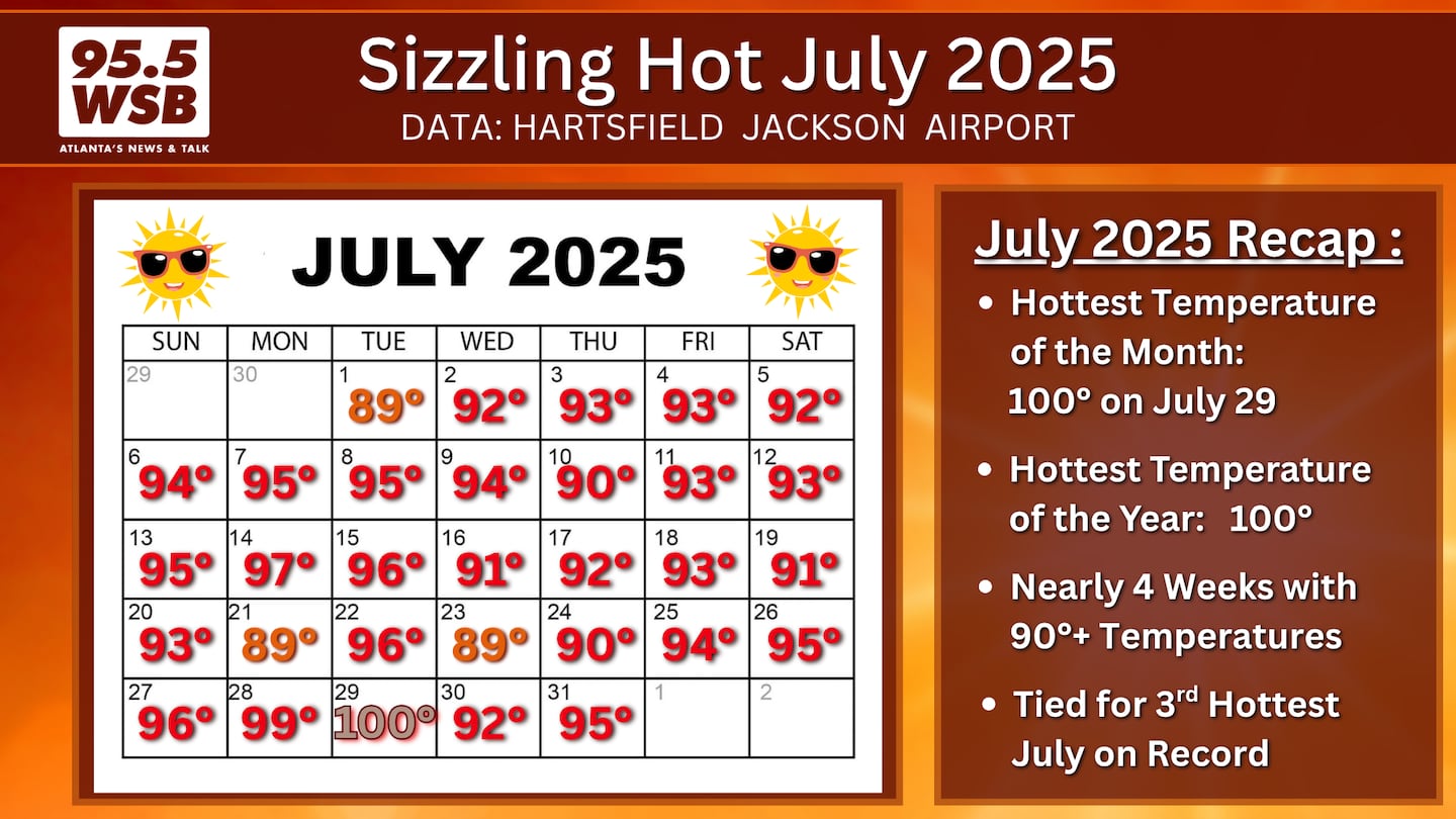
July 2025 is in the books, and it was a sweltering hot month!
Metro Atlanta experienced its third hottest July on record, and we endured nearly four consecutive weeks with 90+ degree temperatures.
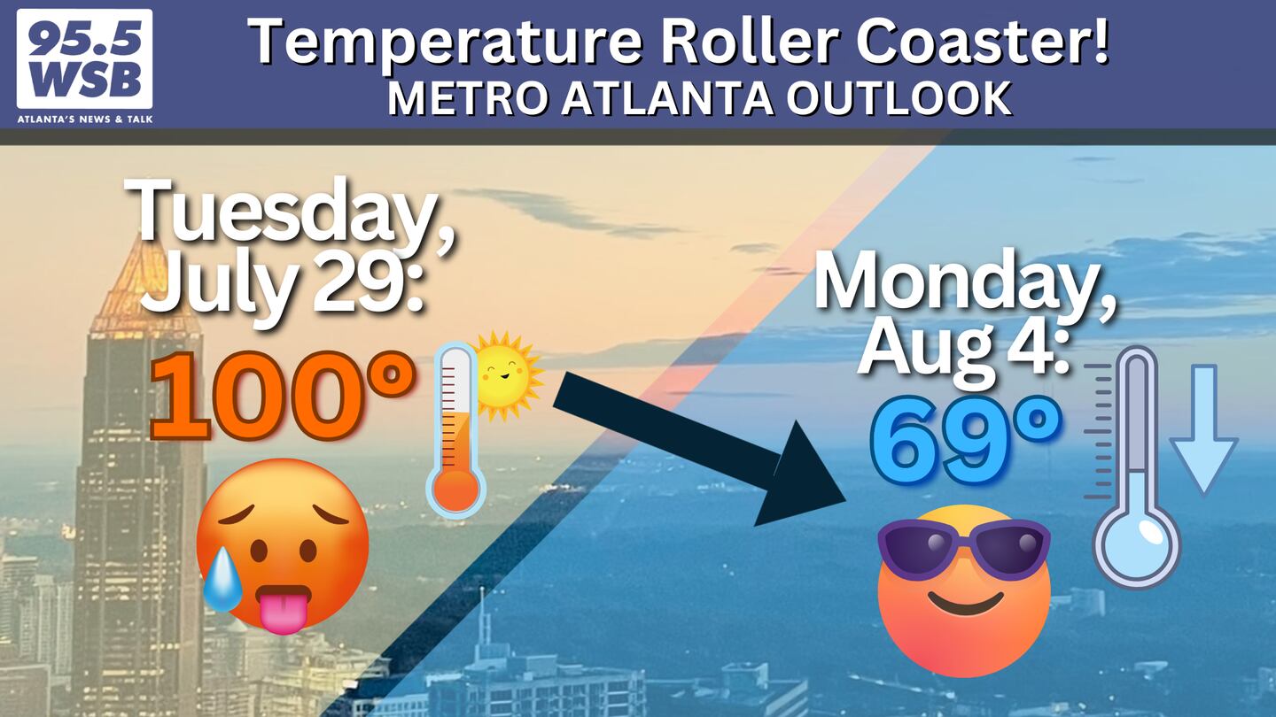
In addition, thermometers reached 100 degrees on Tuesday, July 29, marking the hottest day of the year (so far) for 2025.
But less than one week later, temperatures dropped considerably -- into the upper 60s by Monday, August 4!
In fact, Monday’s high of 69 degrees broke the previous “lowest record high temperature” of 73 degrees for this afternoon set in 1912.
In comparison, the average high for Monday is 90 degrees.
I may be a meteorologist, but I still think it’s *wild* that we went from 100 degrees last Tuesday, to 69 degrees less than one week later!
Since temperatures only made it to 69 degrees, it marks the first day in August with a high in the 60s since August 16-17, 2013.
Before that it was August 30-31, 1986.
Abnormally cool temperatures continue again today as afternoon highs will be limited to the upper 60s to low 70s. In fact, temperatures will stay in the upper 70s to low 80s through Friday!
Enjoying the Break from the Heat?!
This unseasonable cooldown is brought to you by “Our Buddy” The Wedge.
I call it “our buddy” because The Wedge happens pretty frequently in Metro Atlanta --it’s like a “friend” who comes around and visits every so often.
The Metro area is located in the Piedmont of the Appalachian Mountains, which means it is in the southern periphery of the mountain chain.
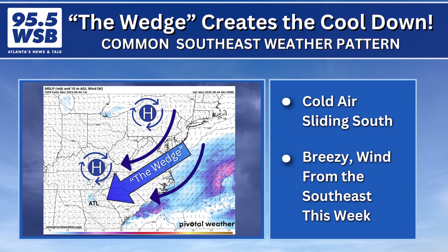
When a pressure system sets up along the East Coast, it forces -- or “wedges” -- cold air into the Appalachian Mountains.
For Metro Atlanta, the “wedge” often sets up when high pressure is located in New England. Other times, the “wedge” develops when low pressure is just off the coast of New England or the coast of the Carolinas.
This air accumulates along the ridge of the mountains, and it is able to rise high enough to create cloud cover, but not necessarily enough to move over the top of the mountain range.
The technical term is “Cold Air Damming” because the cold air funnels down the Appalachian Mountains and “dams” up in the Piedmont region here in Metro Atlanta.
As a result, the cold, dense air oozes or slides south along the mountains before draining in the Piedmont in north and central Georgia.
Easterly winds will continue to push cool, dry air in to Metro Atlanta. Both morning and afternoon temperatures will remain about 10-20 degrees below average through the end of this week, before the air moderates and warms up early next week.
Talk Up a Storm With Me!
Facebook: Christina Edwards WSB
Instagram: ChristinaWSBwx
Twitter: @ChristinaWSBwx
TikTok: @ChristinaEdwards955WSB
©2025 Cox Media Group


 Sign Up

