ATLANTA — The Atlantic Hurricane Season began on June 1 and it will continue through November 30.
While the hurricane season has just begun, be aware that the peak of the season occurs much later in Mid September.
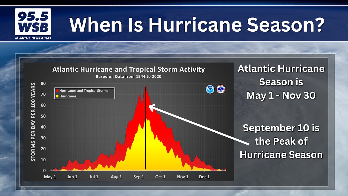
In fact, the bulk of tropical storms and hurricanes form between August 15 and October 15, with the actual peak taking place on September 10.
According to the National Hurricane Center, the average first date for hurricane formation in the Atlantic Ocean basin is August 11. The average first date for a Major Hurricane (Category 3 or higher) formation is September 1, or around Labor Day.
Tracking Tropical Storm Erin
On August 11, Tropical Storm Erin developed in the Atlantic just off the west coast of Africa.
Erin is forecast to strengthen into the first hurricane of the Atlantic season by Thursday, and it will continue to strengthen into a potential Major Hurricane this weekend.
Use the Interactive Tracker below to monitor Erin’s movement and forecast intensity through the next several days.
Weekend Outlook
Looking forward to this weekend, Erin is expected to keep a west-northwest trajectory with a close approach to the Leeward Islands.
The outer rainbands from Erin may swipe the Leeward Islands as well as Puerto Rico, bringing heavy rain, flash flooding, and potentially strong winds.
Anyone with travel interests to the north-eastern Caribbean should continue to monitor the path and speed of Tropical Storm Erin.
Mainland U.S. Impacts Next Week?
Early next week, Erin is expected to curve north and then move east-northeast through the end of next week.
With this path, Erin may possibly bring a direct strike to Bermuda, but it is expected to remain well off-shore of U.S. Mainland soil.
However, rough seas and coastal flooding are possible along the Eastern Seaboard as Erin churns the open ocean waters of the Atlantic.
Are You Sure It Will Curve?
As of this writing, it is still too soon to say for certain that Erin will stay well east of the U.S. Mainland.
However, long-range ensemble models show high probability that Erin will remain east of the U.S., with a potential path between the Eastern Seaboard and Bermuda.
The reason for this curve is due to the steering currents nearby.
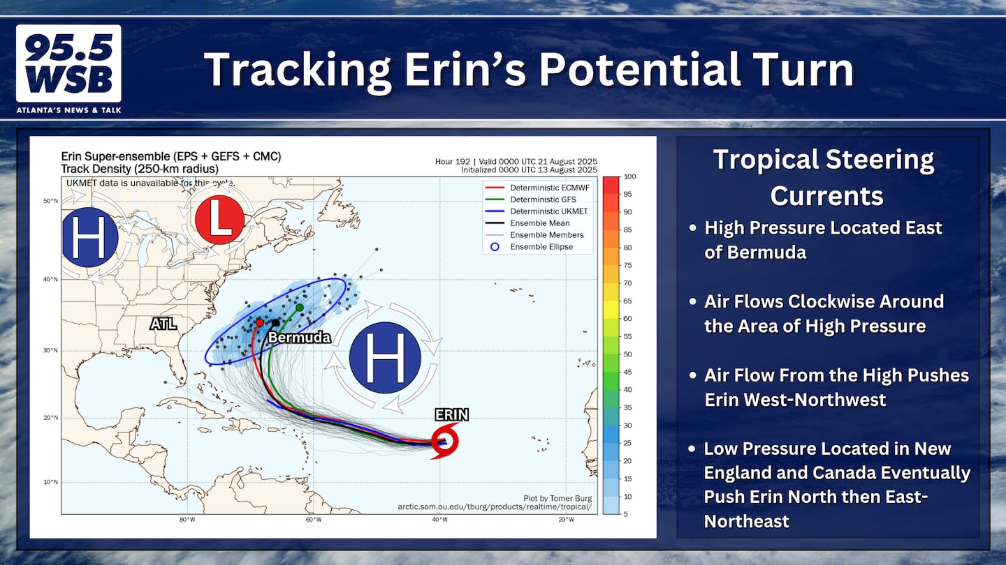
High pressure near Bermuda (often known as the “Bermuda High”) is responsible for steering Erin west towards the U.S.
However, a developing area of low pressure over New England in the Northeast U.S. and southern Canada will then act to “block” Erin, forcing it to curve north before heading north-northeast.
IF the New England low is too weak or too far east, THEN the possibility would open up for Erin to steer further west towards the U.S.
The possibility is low but not zero, and for that reason, it is a good idea to keep an eye on Erin for the next several days.
Track the Tropics With Me!
Facebook: Christina Edwards WSB
Instagram: ChristinaWSBwx
Twitter: @ChristinaWSBwx
TikTok: @ChristinaEdwards955WSB
©2025 Cox Media Group


 Sign Up

