
Tired of the muggy, damp conditions and the nearly daily rainfall this Summer?
Good news! A cold front swept through Metro Atlanta early Monday morning, ushering in a drier air mass that will bring an early taste of Fall this week.
Throughout the Summer months, dewpoint temperatures have stayed in the upper 60s to the mid 70s.
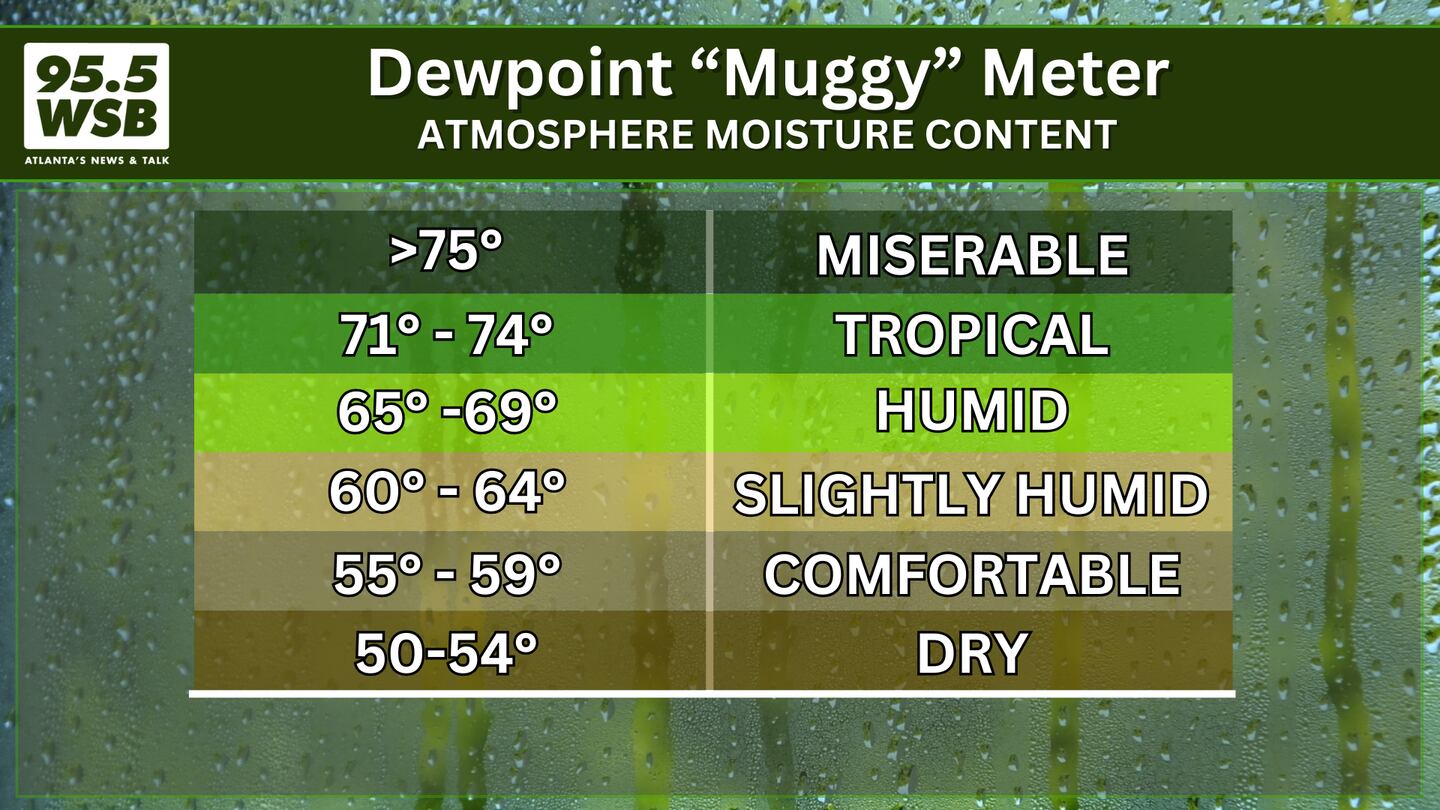
The dewpoint is the measure of atmospheric moisture in the air -- it is the temperature at which air will need to cool in order for water vapor to condense.
In other words, when the air temperature cools and is equal to the dewpoint, then dew will form on the grass and fog will form in low lying areas.
In some cases, rain showers (and in the winter, snow showers) will form when the air has cooled to the dewpoint.
In late Summer to early Fall, relief from the muggy, tropical air arrives in the form of a cold front ushering in drier air from up north.
This week, the dry air will stick around through Thursday, as dewpoints will stay in the low to mid 50s.
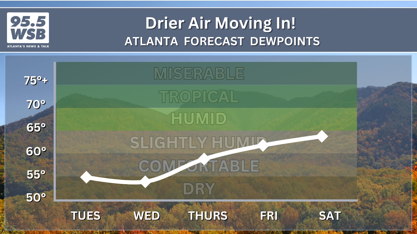
By Friday, dewpoints will climb into the low 60s as our next rain-maker system rolls through the Southeast U.S.
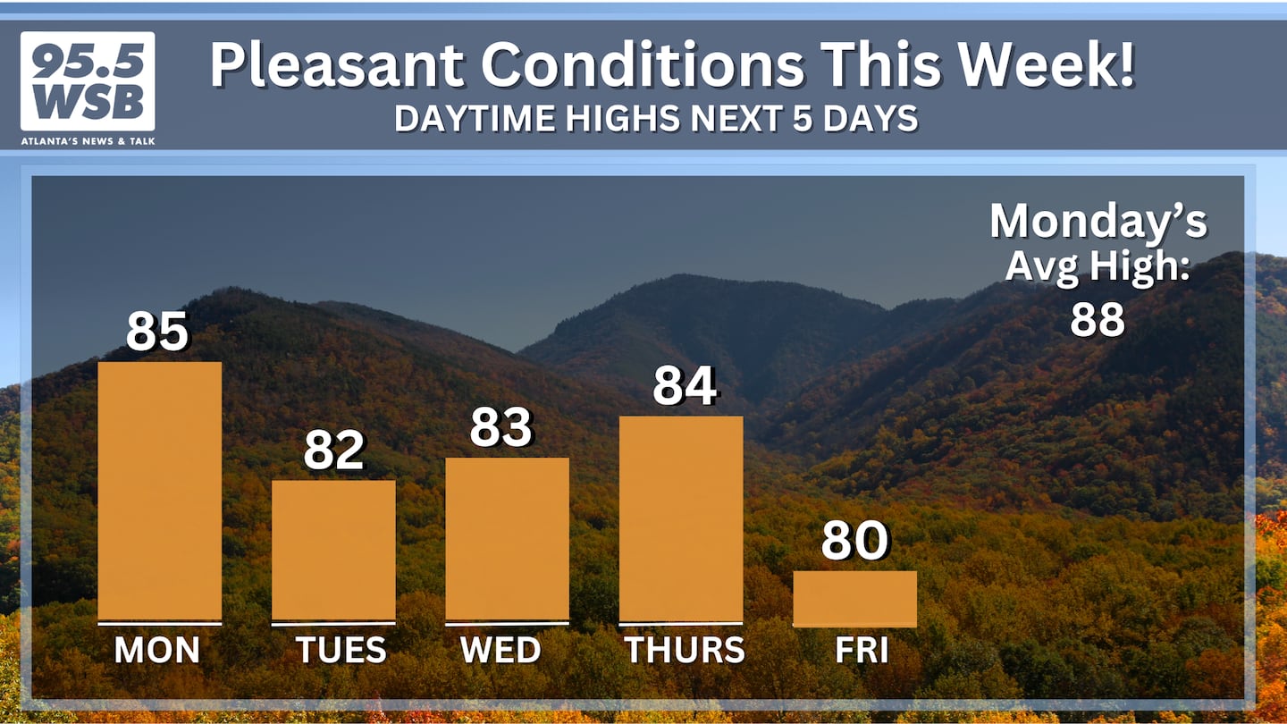
Until then, enjoy afternoon temperatures in the mid-80s, which will actually feel like the mid-80s as the low dewpoints will in turn create low humidity levels.
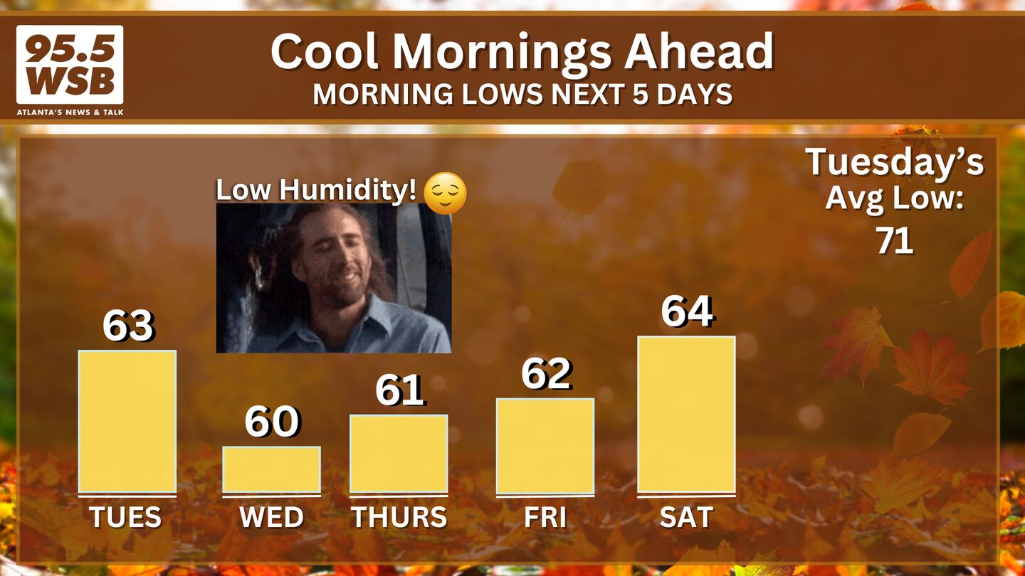
And just in time for the return of the Pumpkin Spice Latte, sunrise temperatures will drop into the upper 50s to low 60s on Tuesday and Wednesday mornings!
Share Your Temperature Reports With Me!
Facebook: Christina Edwards WSB
Instagram: ChristinaWSBwx
Twitter: @ChristinaWSBwx
TikTok: @ChristinaEdwards955WSB
©2025 Cox Media Group


 Sign Up

