
Rain and thunderstorms return to the forecast this weekend, beginning early Saturday morning.
While it won’t rain every hour of the day Saturday and Sunday, do be aware that a cold front will try to push a series of thunderstorm clusters into North Georgia Saturday morning, with more clusters potentially arriving on Sunday.
Saturday Morning Timeline
A line of heavy rain and thunderstorms will move south from the North Georgia Mountains through Metro Atlanta Saturday morning, impacting the Metro area between 5am and 11am.
The animation below illustrates the Futurecast Radar Imagery for Saturday morning.
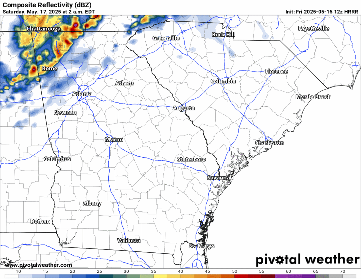
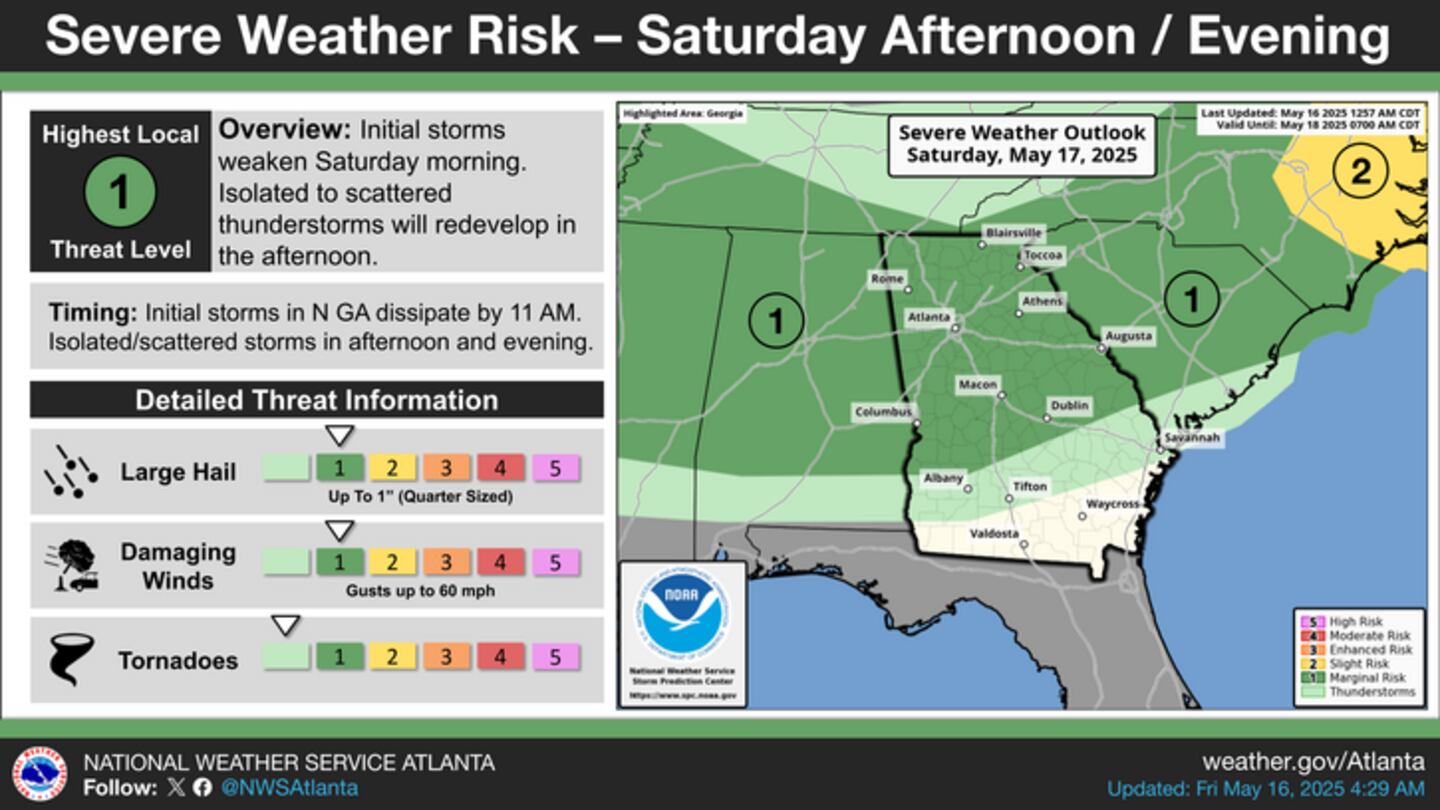
These storm clusters may produce damaging wind gusts as well as large hail as they move through.
Sunday Rain Timeframe
Additional scattered showers and thunderstorms remain in the forecast Sunday, however the high-resolution model data is not quite available for Sunday’s time frame.
A cold front will stall over Middle Georgia Sunday morning, opening the door for more scattered showers and thunderstorms throughout the day late Sunday morning through the afternoon.
Severe storms are not anticipated for Sunday, however an isolated damaging wind gust cannot be ruled out for some of the stronger storms.
Share Your Rainfall Reports With Me!
Facebook: Christina Edwards WSB
Instagram: ChristinaWSBwx
Twitter: @ChristinaWSBwx
TikTok: @ChristinaEdwards955WSB
©2025 Cox Media Group


 Sign Up

