
I’ve fielded a few questions about our rainfall lately, specifically whether or not we’ve received too much or too little.
A low pressure system swirled through North Georgia this weekend, and the brunt of the rain fell during the Monday morning commute.
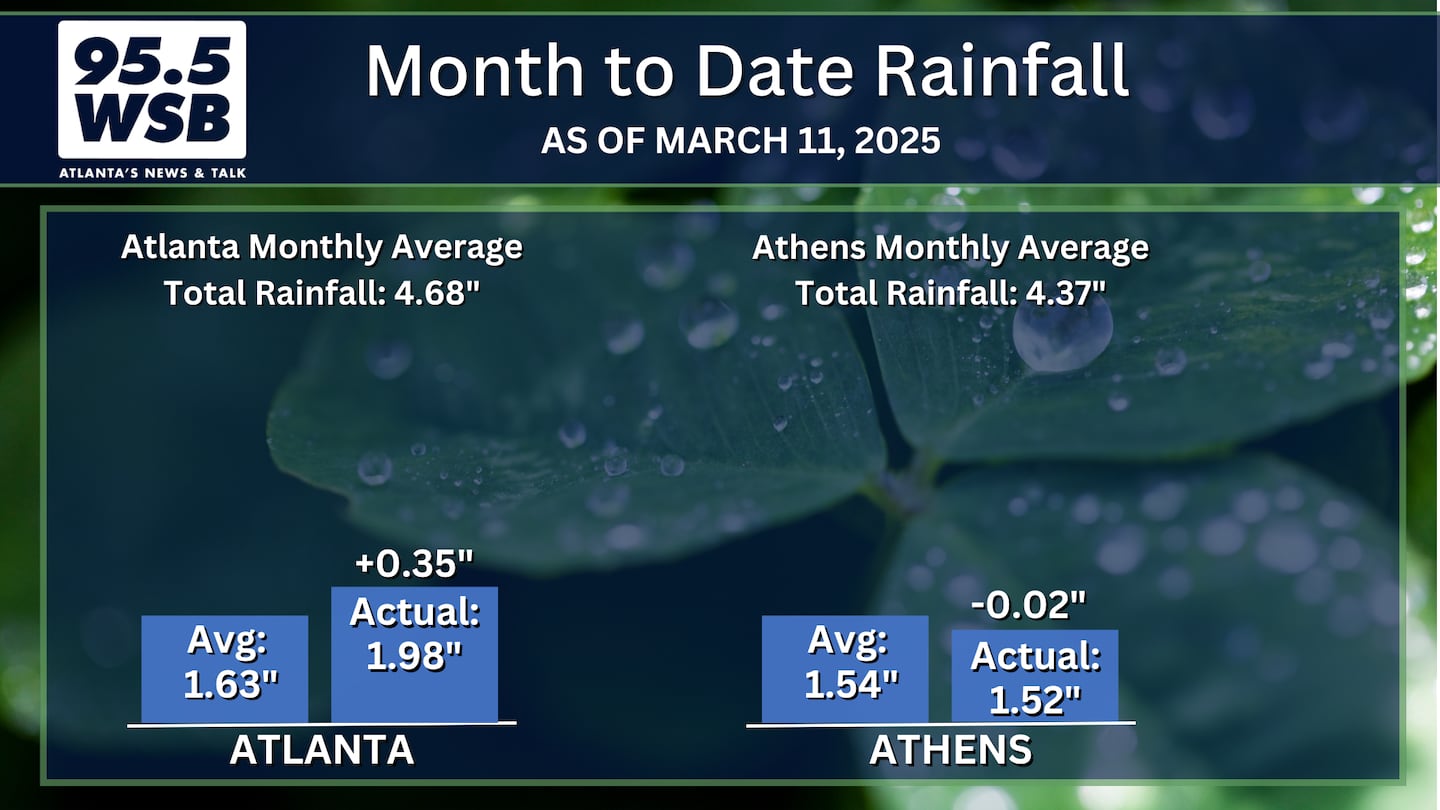
The system was a prolific rainmaker, and some areas of the region picked up nearly 2 inches of rainfall.
This was the second of two rounds of rainfall this month (March 1 through 11), which is helping tremendously. Remember: The final half of February was quite dry, with nearly 2 weeks of no rainfall and quite a few days in the upper 70s (with gusty winds).
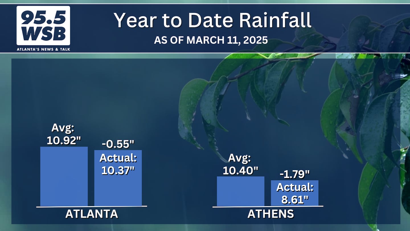
Below are the Month to Date and Year to Date rainfall totals for Atlanta and Athens.
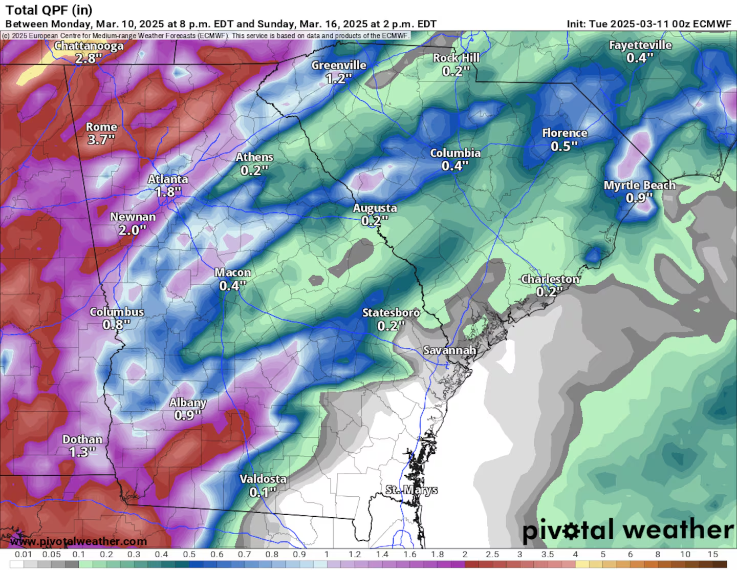
Another 1 to 3 inches of rainfall is possible along with the severe storm system rolling through later this weekend.
Speaking of the Weekend Storms...
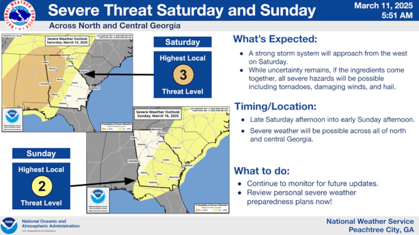
The potential for severe weather this weekend (Saturday night into Sunday Morning) is increasing.
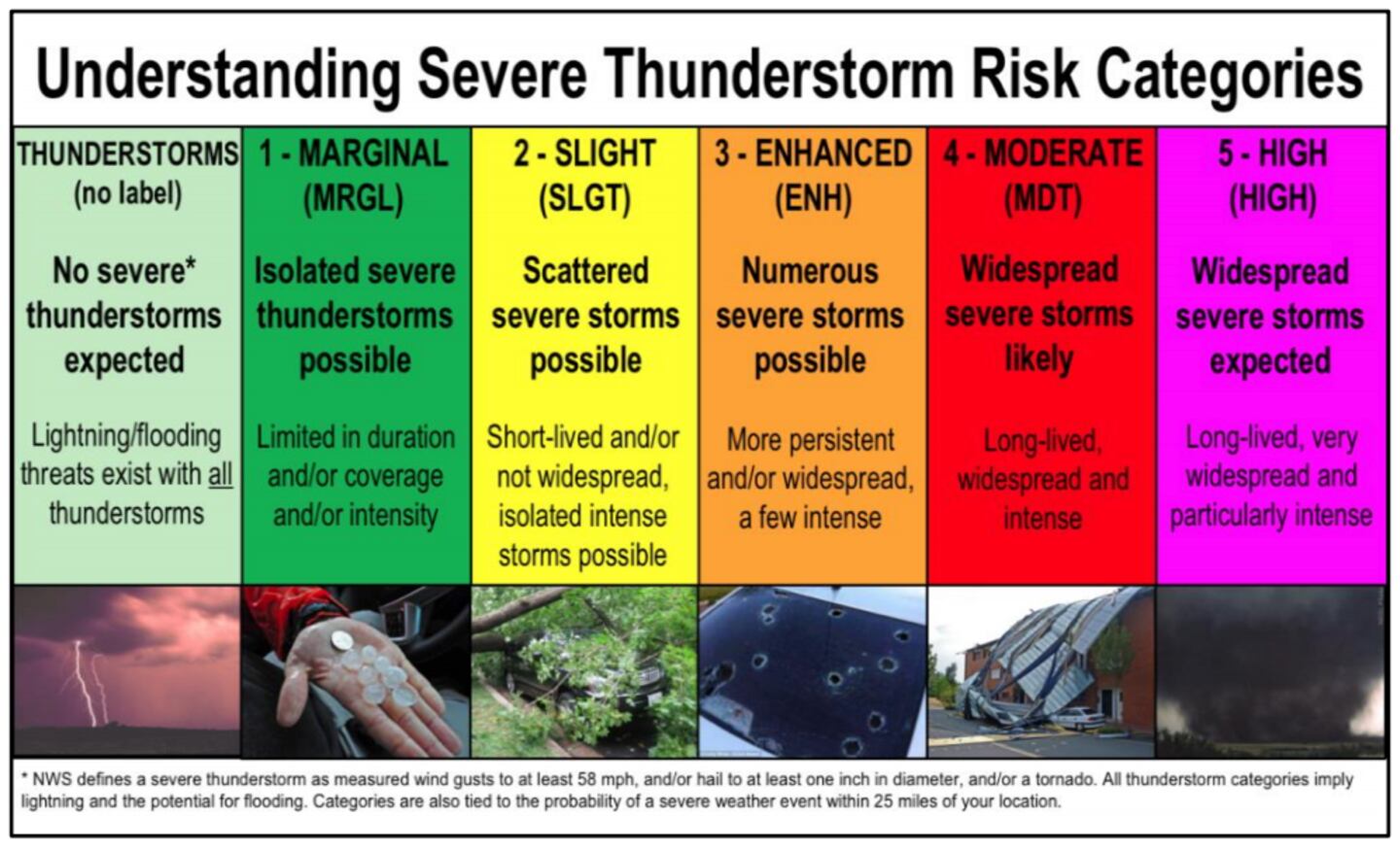
Seeing a 30% Orange outline this early is indicative of a very strong storm system moving through our area.
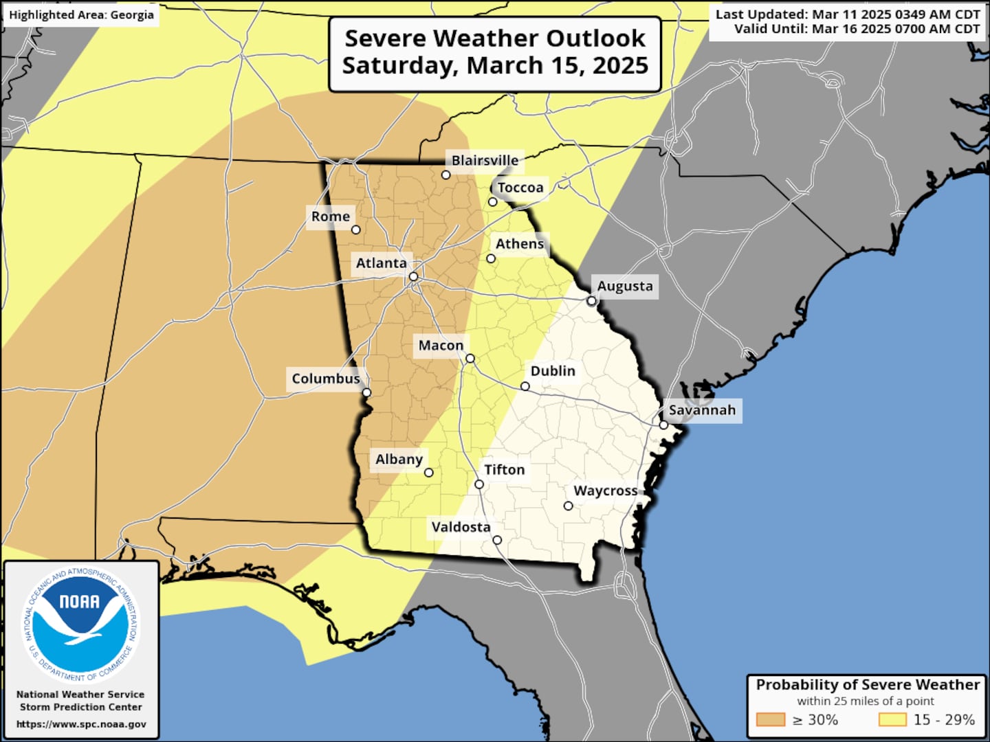
This corresponds to an “Enhanced Risk” or Level 3 out of 5 on the Severe Weather Convective Outlook.
It’s too soon to know the timing/when/where details, but there is a very good chance of damaging winds late Saturday night into Sunday morning. Unfortunately, tornadoes are also possible.
A lot of St. Patrick’s Day festivals and activities are scheduled for this weekend.
If you are an event planner, please keep an eye on the weather forecast for Saturday PM/early Sunday AM.
Share Your Rainfall and Storm Reports With Me!
Facebook: Christina Edwards WSB
Instagram: ChristinaWSBwx
Twitter: @ChristinaWSBwx
TikTok: @ChristinaEdwards955WSB
©2025 Cox Media Group


 Sign Up

