The potential for severe weather this weekend -- Saturday night into Sunday Morning -- is increasing.
The Storm Prediction Center has outlined the majority of Metro Atlanta in an *ENHANCED RISK* for severe storms, or a Level 3 out of 5 regarding the Severe Weather Convective Outlook.
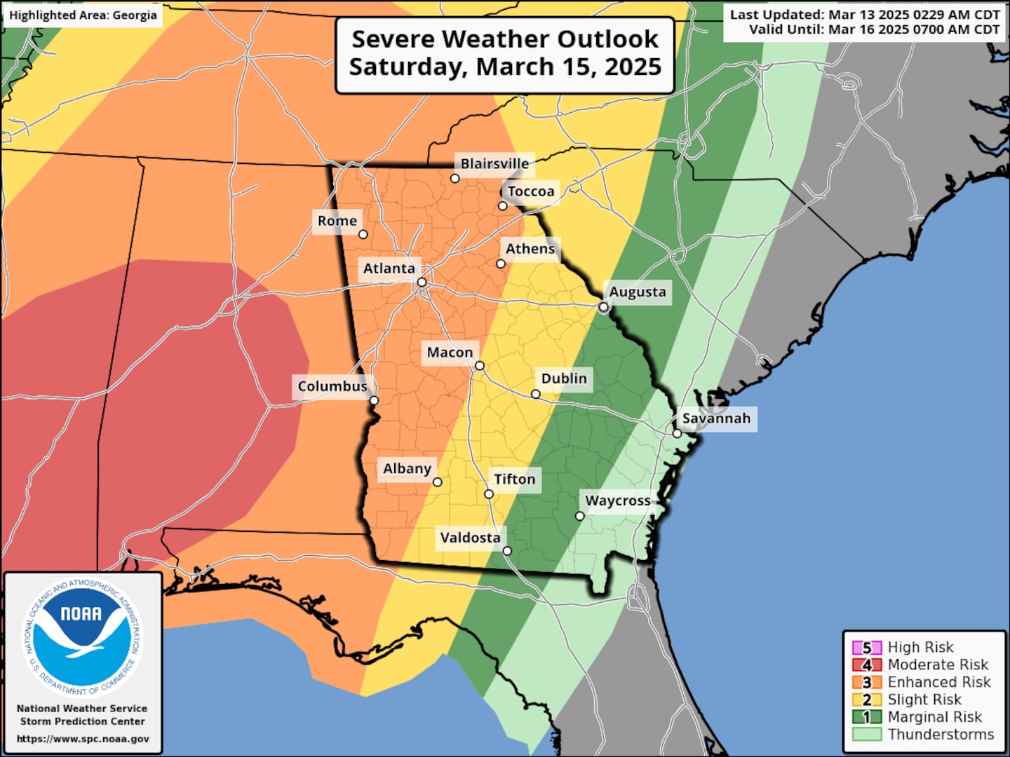
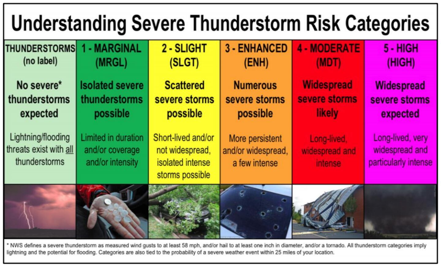
The Storm Prediction Center notes that Metro Atlanta -- and much of north and western Georgia -- has a 30 to 44 percent chance of experiencing a severe storm within 25 miles of a given point.
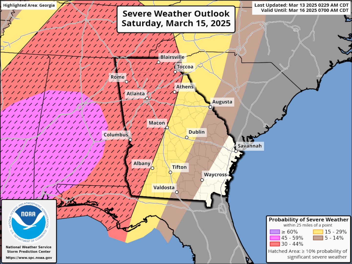
In other words, the potential for damaging winds, hail, and tornadoes at any given point in north and western Georgia is high enough to begin taking precautions.
Timeline: Late Saturday Night to Early Sunday Morning (Overnight Hours)
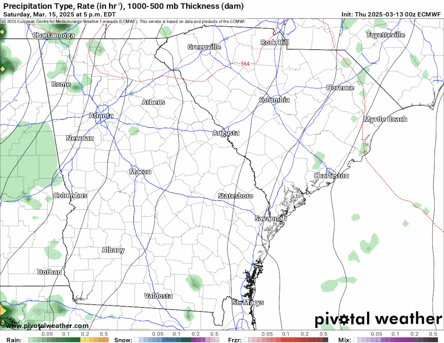
The timeline will be finessed throughout the day today and again tomorrow, but the window for severe storms is between 10pm Saturday and 6am Sunday morning. The animation below illustrates the long-range Futurecast radar for Saturday night into Sunday morning. It is important to note that high-resolution short range data will become available later this afternoon.
Potential Impacts
These severe storms will be capable of the following:
- Wind gusts 60+ mph (strong enough to knock down trees and powerlines)
- Large hail (diameter 1 inch or greater)
- Tornadoes are also possible, some may be rather strong and capable of producing considerable damage
Continue to monitor the weather forecasts heading into the weekend, and have cellphones and tablets charged before Saturday night.
Share Your Storm Reports With Me!
Facebook: Christina Edwards WSB
Instagram: ChristinaWSBwx
Twitter: @ChristinaWSBwx
TikTok: @ChristinaEdwards955WSB
©2025 Cox Media Group


 Sign Up

