NORTH GEORGIA — The National Weather Service in Peachtree City finalized their storm damage survey and analysis of the Saturday, June 7, 2025 severe storm event.
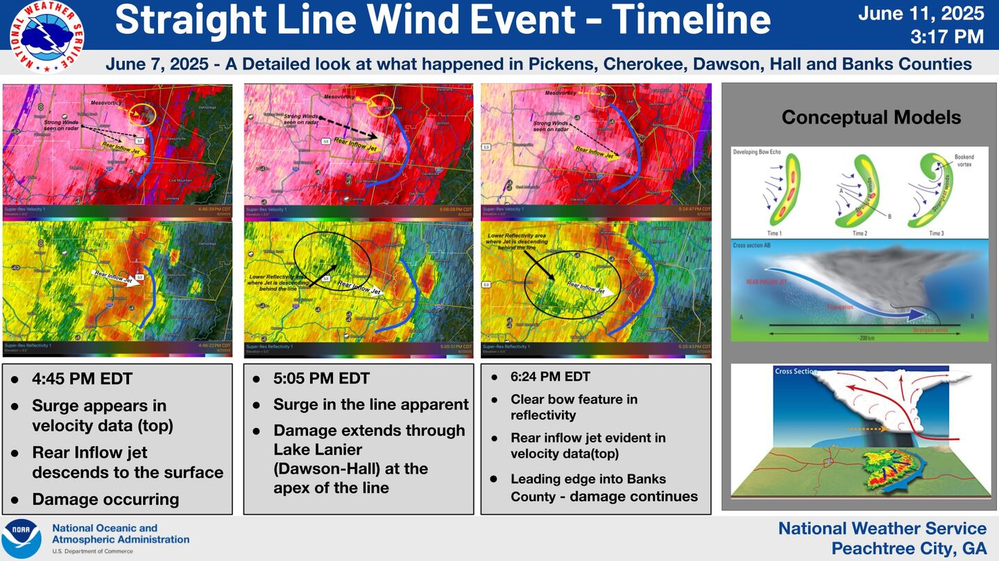
During their analysis -- which includes comparing radar data to storm damage in the field -- the NWS determined a series of bowing storm structures capable of producing straight line winds as high as 95 mph.
According to the NWS, “wind damage extended for over 50 miles from Pickens County through northern Cherokee, Dawson, Hall, and into Banks Counties.”
“Areas of damage (mostly trees) were as wide as 1 to 1.5 miles in places.”
We have completed our survey/analysis of some of the more significant wind damage from storms Sat June 7th. A...
Posted by US National Weather Service Peachtree City Georgia on Wednesday, June 11, 2025
The NWS also notes that areas in eastern Dawson County near Lake Lanier were impacted by microbursts, which are a type of downbursts within a severe thunderstorm.
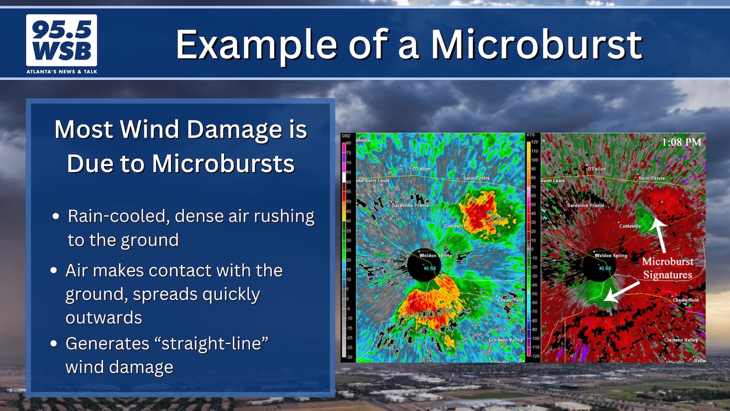
What is a Downburst? What is a Microburst?
A downbursts forms when dense, rain-cooled air rushes quickly to the ground.
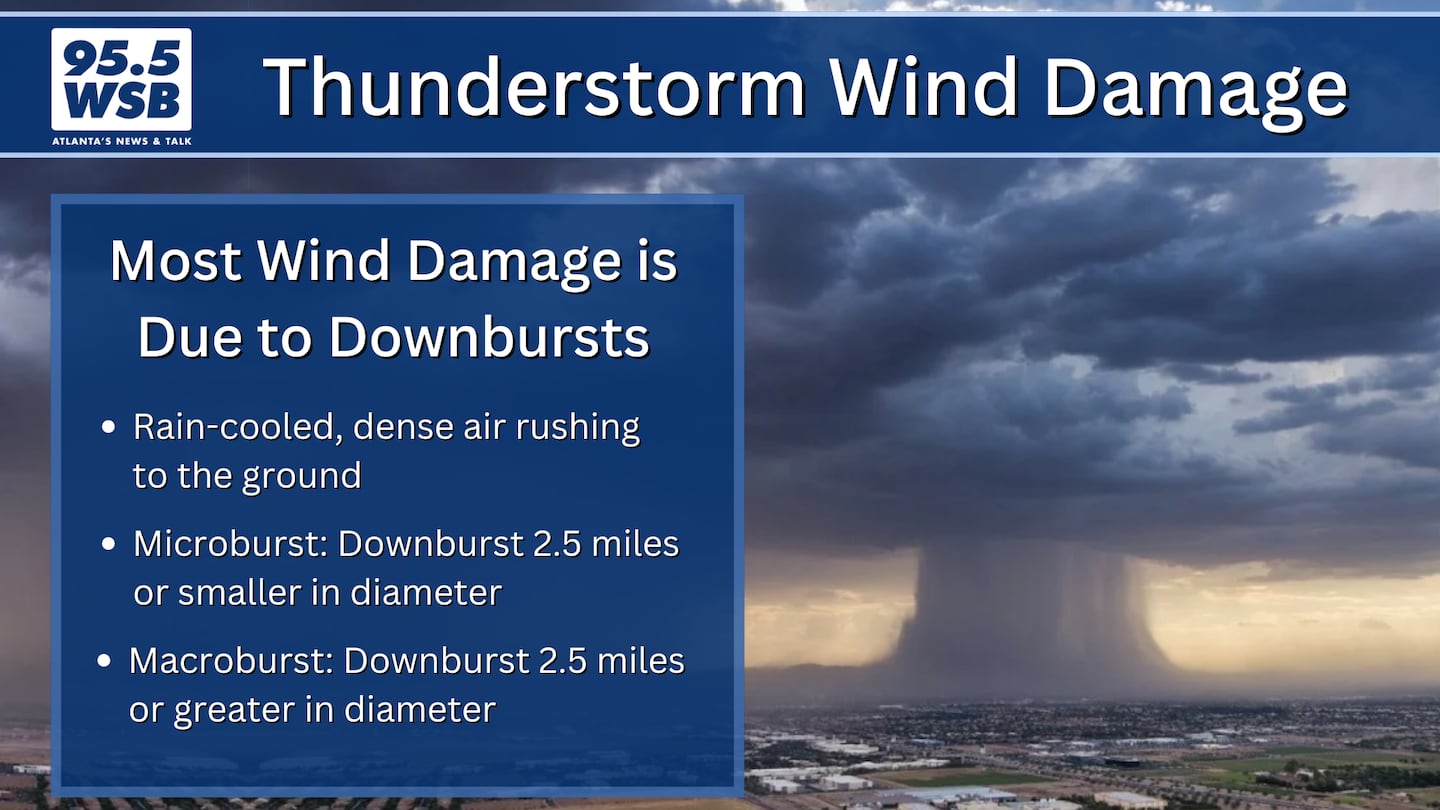
Downbursts that are 2.5 miles or smaller in diameter are known as “microbursts”, where as “macrobursts” occur when the downburst is larger than 2.5 miles in diameter.
What Happened Saturday, June 7, 2025?
The National Weather Service in Peachtree City notes on its Facebook page:
“The [graphic below] shows the area we surveyed in green dots and the estimated area where wind damage was either observed or estimated.”
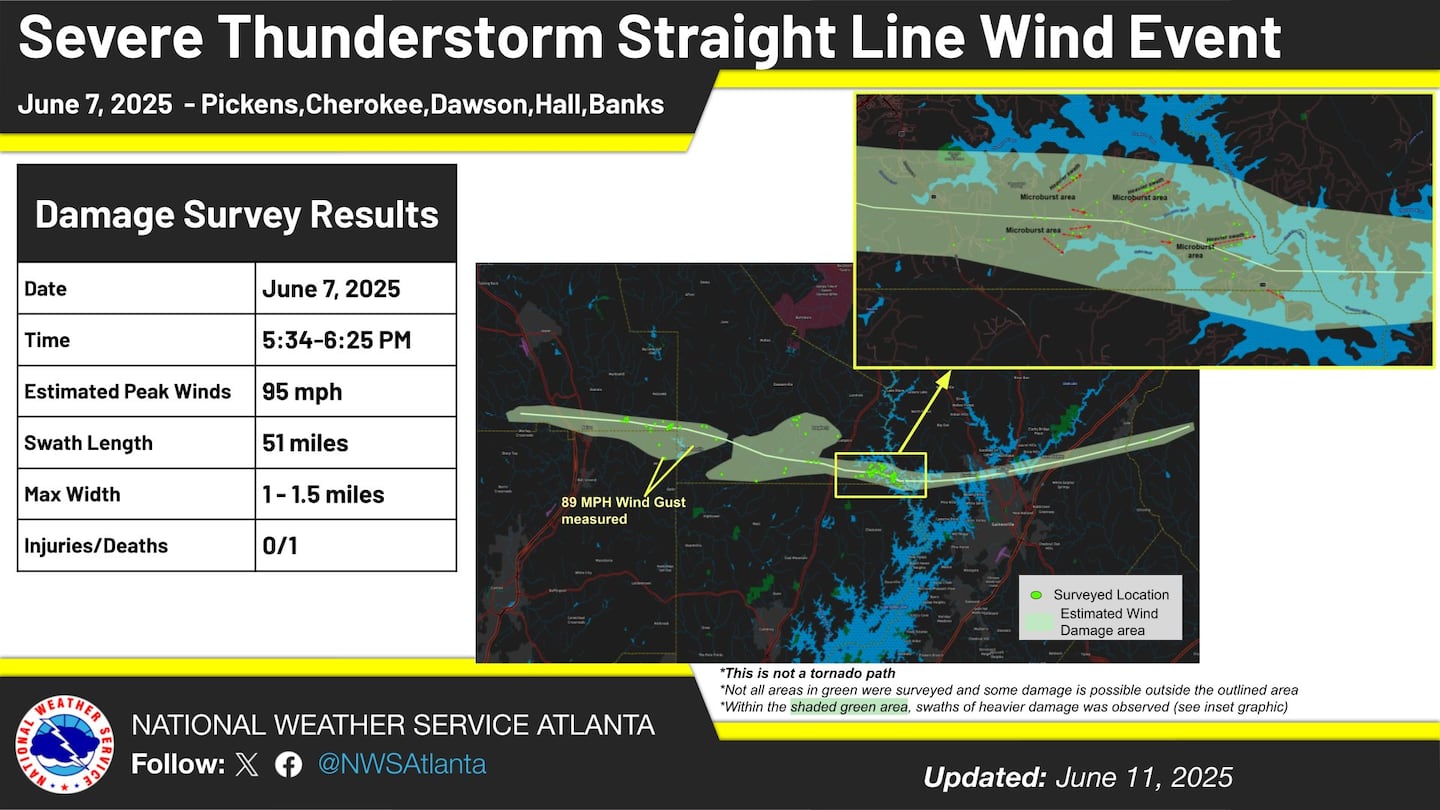
“A detailed survey in eastern Dawson County near Lake Lanier revealed several microburst areas which contributed to swaths of greater tree damage.”
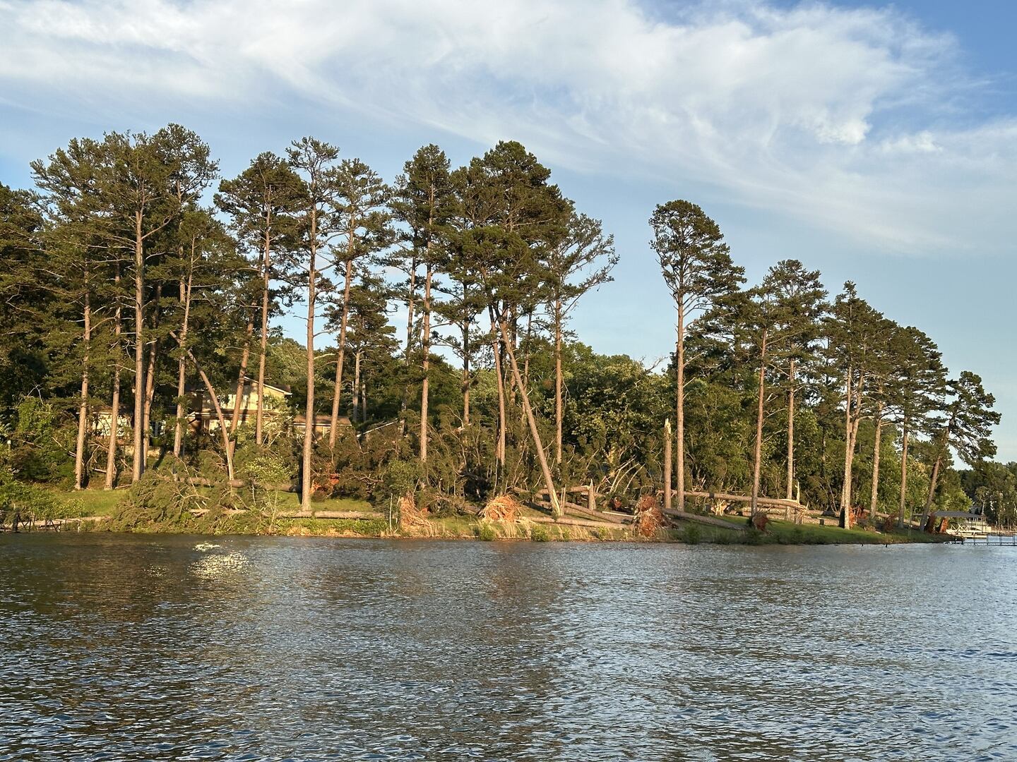
“These microburst areas produced an estimated 95mph wind, strong enough to snap and uproot many trees in the vicinity including onto homes.”
“This pattern was repeated many times not just in Dawson, but also Pickens, Cherokee, Hall and Banks Counties as well. [Two] separate Davis weather stations owned by Emergency Management in Cherokee and Dawson Counties recorded 89.1mph and 89.5mph wind gusts respectively within the wind swath area.”
The detailed Damage Survey assessment is available on the National Weather Service’s Public Information Statement page.
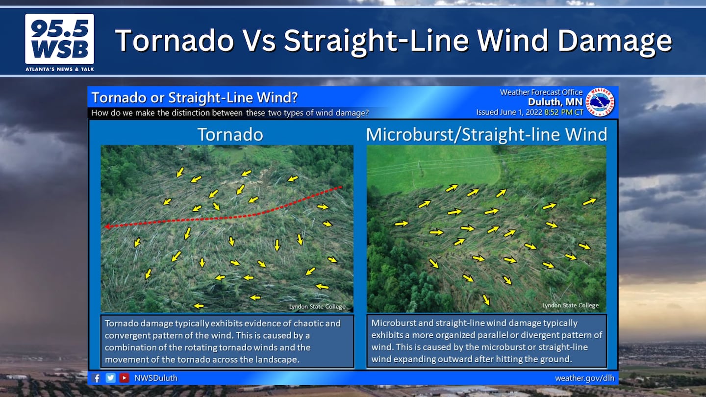
“You Sure It Wasn’t a Tornado?!”
On the Enhanced Fujita (EF) Scale, a tornado producing 95 mph winds would be rated an EF-1.
So it’s understandable to think that if a storm produced 95 mph winds, it had to be a tornado, right?!
Remember: Summertime storms often produce bowing winds that can reach 60-80 mph and occasionally as high as 90-100 mph, but those winds are moving in a straight line -- they’re not moving in a twisting pattern.
In the example below, the red and green shows air moving away from each other, as opposed to twisting towards each other.
But wind damage is still wind damage, no matter if it’s twisting or moving in a straight line!
During the summer, if you are ever in a Severe Thunderstorm Warning, treat them seriously, as wind gusts can still be quite damaging -- even without a tornado causing the damage.
Share Your Storm Reports With Me!
Facebook: Christina Edwards WSB
Instagram: ChristinaWSBwx
Twitter: @ChristinaWSBwx
TikTok: @ChristinaEdwards955WSB
©2025 Cox Media Group


 Sign Up

