Warm and humid conditions are present today, and afternoon sunshine will heat the atmosphere allowing scattered showers and thunderstorms to develop later this afternoon and evening.
These storms will be rather “pop up” in nature, however some will be strong to severe with potential damaging wind gusts as well as large hail (1+ inch in diameter).
As a result, the Storm Prediction Center and the National Weather Service have issued a Severe Thunderstorm Watch for North Georgia -- including northern Metro Atlanta -- through 12am Friday.
FFC issues Severe Thunderstorm Watch for Banks, Bartow, Catoosa, Chattooga, Cherokee, Dade, Dawson, Fannin, Floyd, Forsyth, Gilmer, Gordon, Hall, Lumpkin, Murray, Pickens, Towns, Union, Walker, White, Whitfield [GA] till May 9, 12:00 AM EDT https://t.co/4Nl3QNI4Fy pic.twitter.com/Xr3w8WYnHt
— Christina Edwards (@ChristinaWSBwx) May 8, 2025
Areas north of I-20 have the best chance to encounter some of these strong to severe storms.
Use the Interactive Radar Map below to track the storms as they arrive into North Georgia.
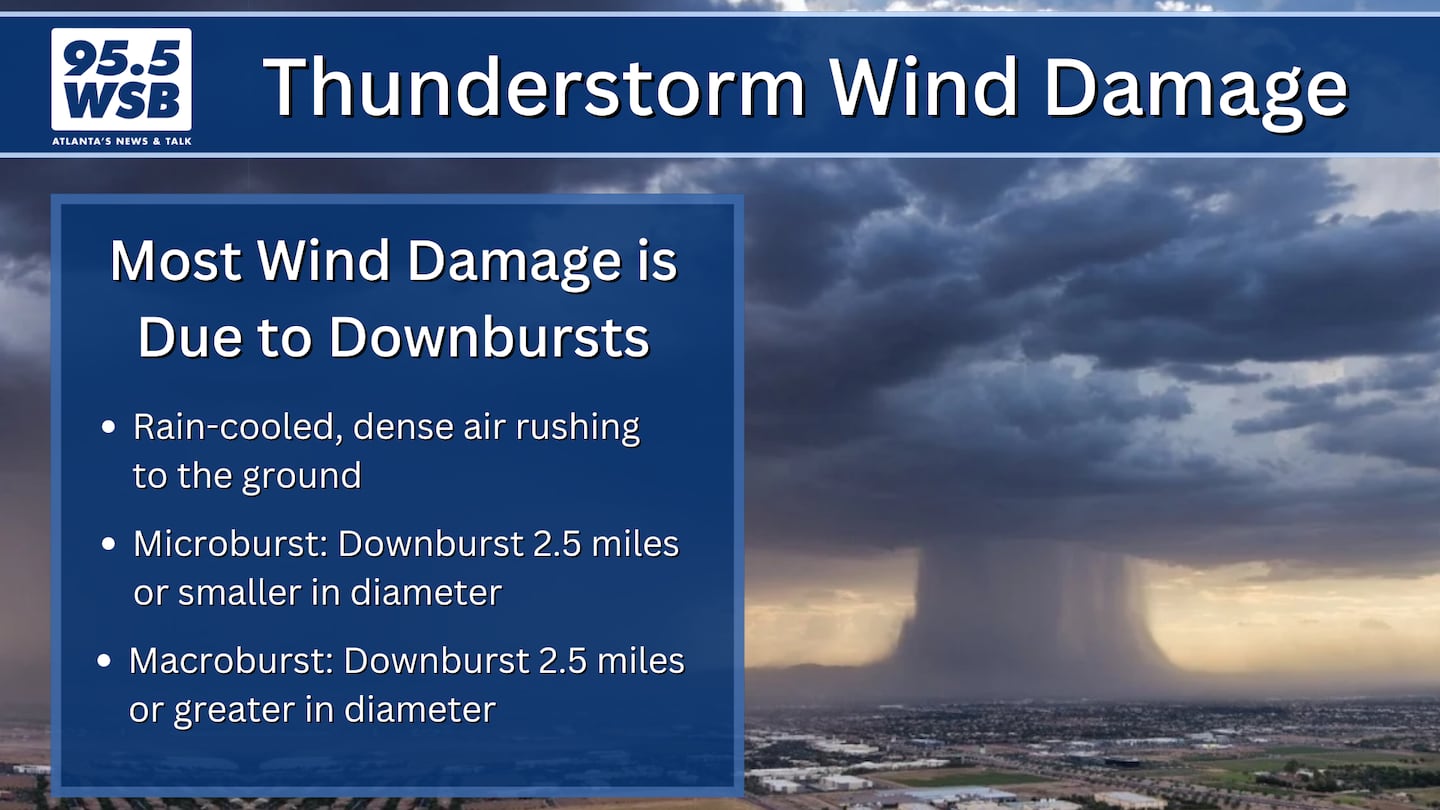
Damaging Wind Gusts Possible
Any storms that develop will have the potential to produce damaging wind gusts as high as 60 mph.
Weather balloon data this morning shows a layer of dry, cool air in the mid-atmosphere. As storms develop, the falling rain will transfer some of this cool, dense air to the ground, potentially creating microbursts that could damage trees and buildings.
The Key to Forecasting Hail
During the spring and summer months, some of these pop up storms are capable of producing hail.
One of the clues that I monitor for regarding hail is an “inverted V” that appears on the dewpoint data in an upper air sounding (this data is obtained by the weather balloons released by the National Weather Service twice per day).
The “inverted V” indicates a pocked of dry air in the low to mid levels of the atmosphere. This pocket of dry air allows rain drops higher up in the cloud to encounter more evaporative cooling, which facilitates the freezing and growth of hailstones.
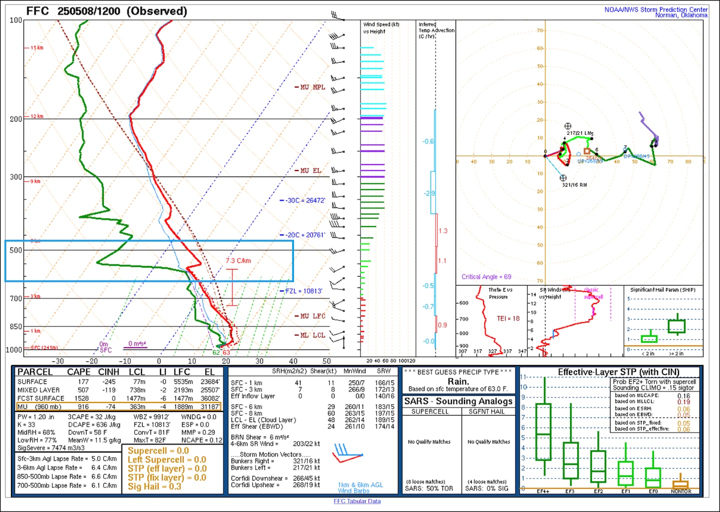
The “inverted V” is present in the balloon data today. In addition to heavy rain, some storms may be capable of producing quarter-size to golf ball-size hail.
0 of 4


Share Your Storm Reports With Me!
Facebook: Christina Edwards WSB
Instagram: ChristinaWSBwx
Twitter: @ChristinaWSBwx
TikTok: @ChristinaEdwards955WSB
©2025 Cox Media Group


 Sign Up

