
ATLANTA — It’s not your imagination!
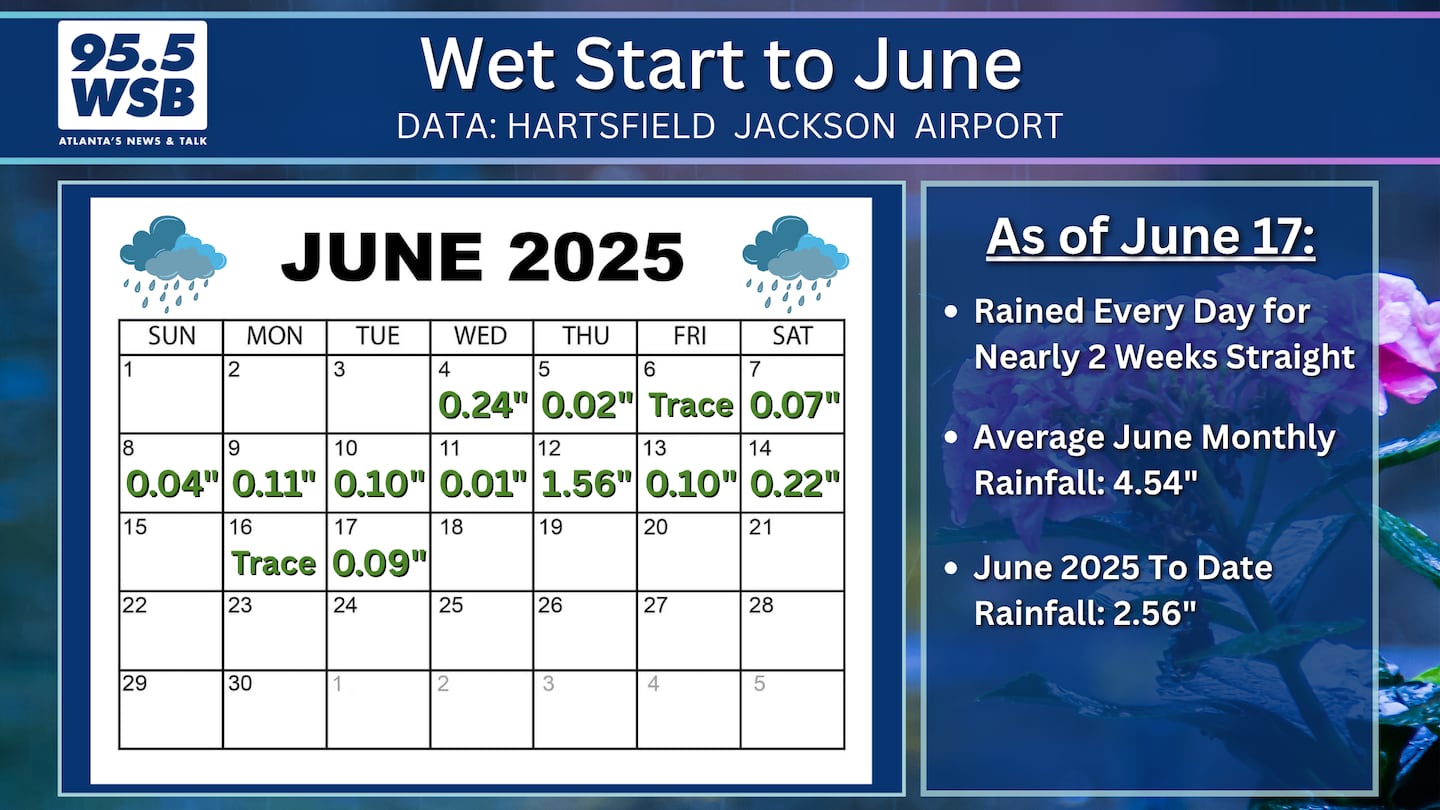
For nearly two weeks straight, it has rained every day in the Metro Atlanta area!
In fact, an 11-day stretch of daily rainfall occurred between June 4 and June 14. A brief break occurred on Father’s Day, but heavy rain returned for the beginning of this week.
Another round of heavy rain and storms will occur Thursday before a pattern shift arrives over the weekend.
The animation below illustrates the Futurecast Radar for Thursday.
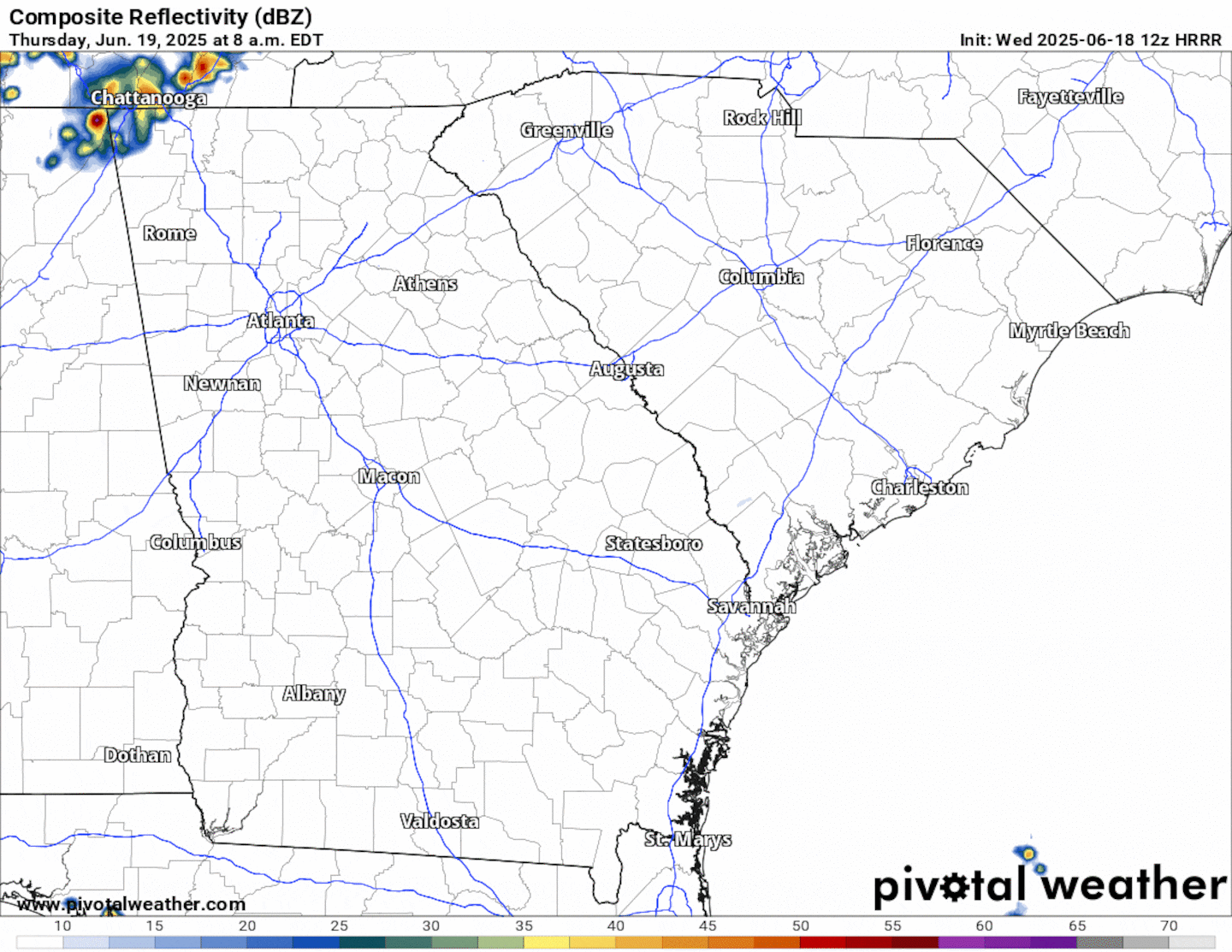
An additional 0.5 inch to 1 inch of rainfall is possible from these showers and storms.
Is this Record Rainfall for Atlanta?
Not quite!
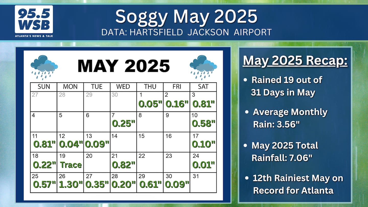
May 2025 did reach the 12th Wettest May on Record for Atlanta with 7.06 inches. However, the Wettest May on Record occurred in 2003, with 9.94 inches.
So far, June 2025’s rainfall is trending above average, but it does not crack the Top 10 when it comes to the first two weeks of rainfall.
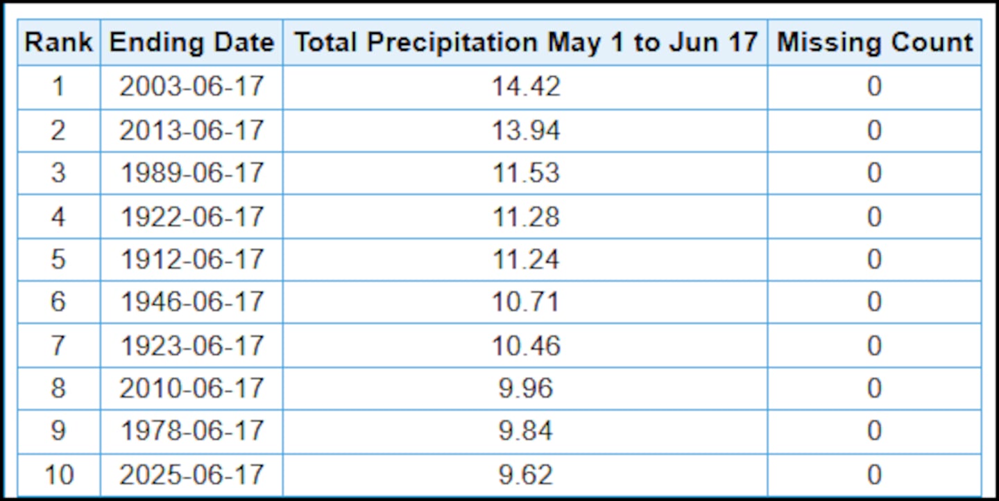
But, when May and June’s rainfall is combined, it is on track for the Top 10 Wettest on record for May 1 through June 17.
Silver Linings to the Rain Clouds
As dreary and soggy as the weather has been during the month of June -- and indeed, since May as well -- there are a few silver linings to the rain clouds.
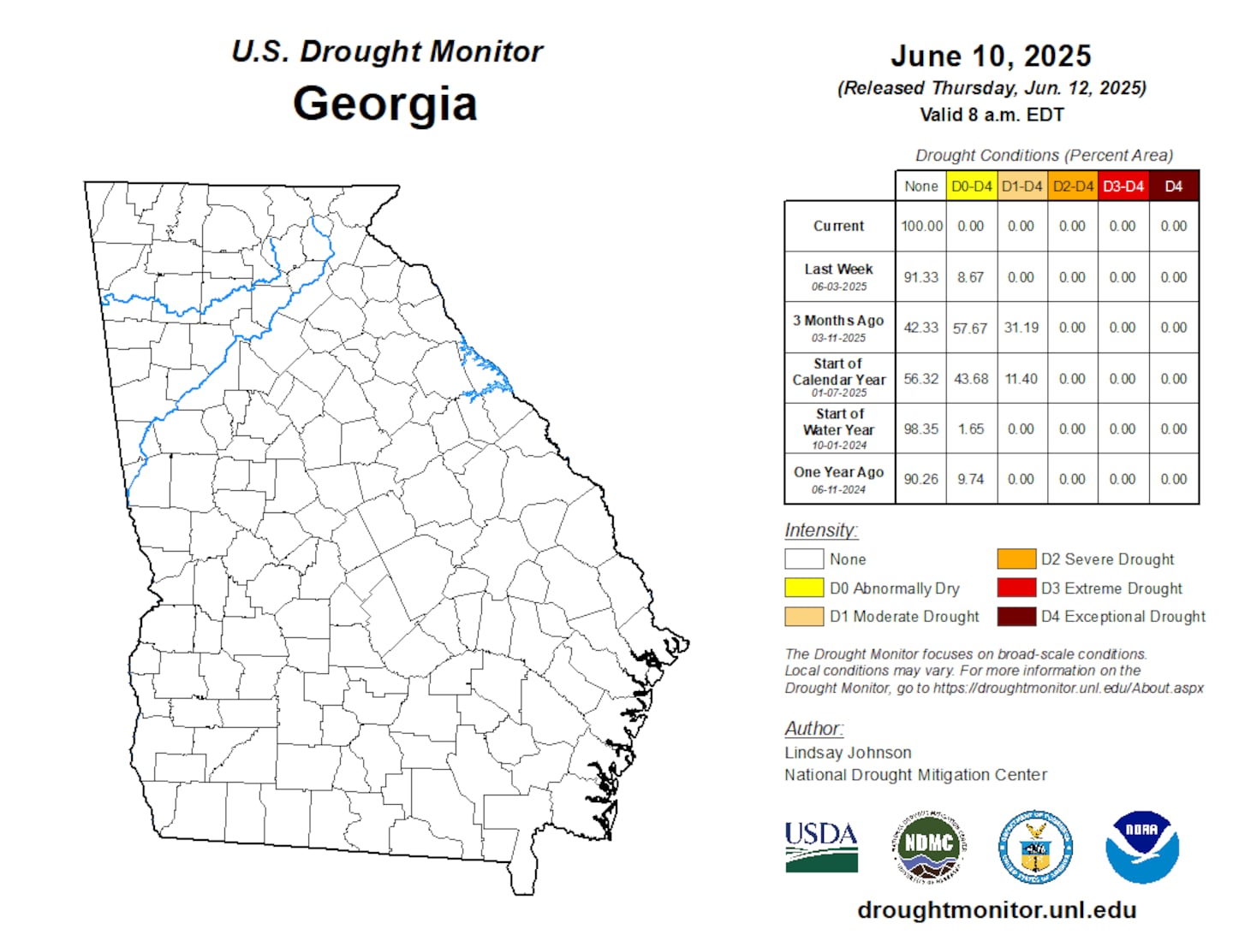
The entire state of Georgia is registering drought-free conditions for the first time since May 28, 2024. At the beginning of the year, as much as 56 percent of the state was experiencing Abnormally Dry (D0) conditions, and 44 percent of the state was experiencing a D1 Moderate Drought.
Afternoon highs have remained limited to the mid to upper 80s. In fact, Atlanta has only registered 90+ degree temperatures 3 times since June 1
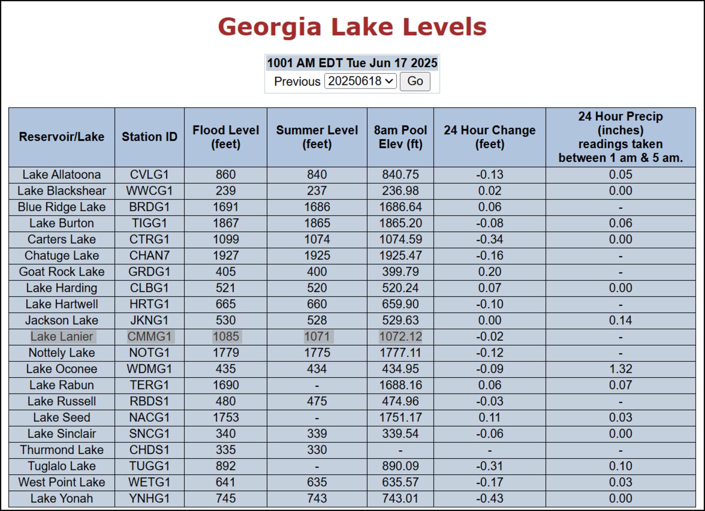
Lake Lanier levels have remained at or slightly above Summer Pool Level (1071 ft) since early May.
Pattern Change: Drier weather on the way?
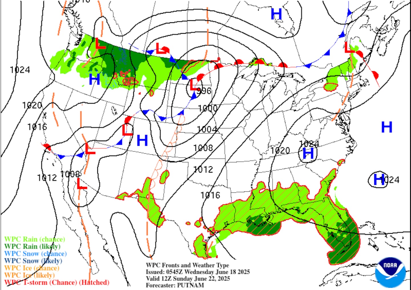
The reason for June’s rainy weather pattern is a stubborn high pressure system sitting just off the Carolina Coast.
This high is responsible for pushing Gulf Moisture into the Southeast, prompting the daily pop up showers and storms.
In addition, a series of upper level troughs moved through Mississippi, Alabama, and Georgia, generating the strong to severe thunderstorms that have impacted our area since mid-May and early June.
However, the high pressure system will slowly move west and anchor over the southern Appalachian Mountains. With high pressure over the Southeast, the rain chances will drop to an isolated 10 to 20 percent.
However, as the rain clouds move out, the heat will start to build! Expect daily temperatures to climb into the low to mid 90s this weekend, and they will potentially climb into the upper 90s by the middle of next week!
Share Your Rainfall Reports With Me!
Facebook: Christina Edwards WSB
Instagram: ChristinaWSBwx
Twitter: @ChristinaWSBwx
TikTok: @ChristinaEdwards955WSB
©2025 Cox Media Group


 Sign Up

