
The first week of February featured afternoon temperatures in the 70s, and the second week of February was marked by torrential rainfall.
The third week of February will bring an Arctic Blast that will send morning temperatures into the low 20s by the end of this week, and daytime highs will be limited to the upper 30s to mid 40s.
Is Wintry Precipitation in the Forecast?
The answer is both “Yes” and “No”.
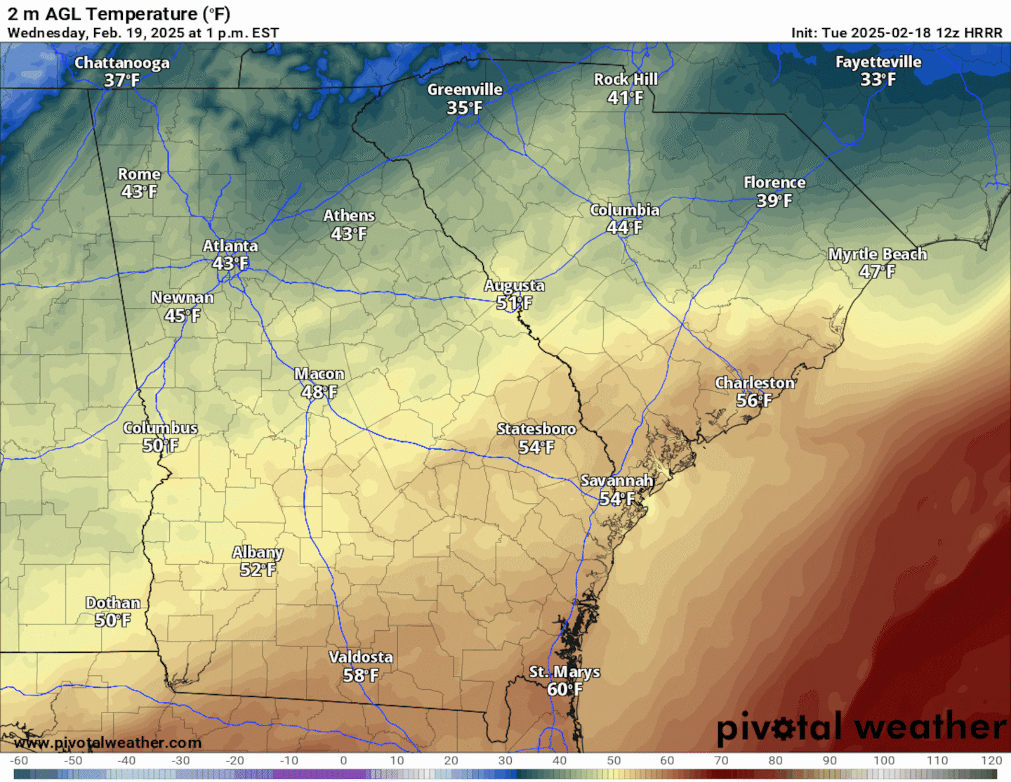
A Gulf Low will swing through the Southeast today and Wednesday, bringing rain showers to much of the state of Georgia.
For Metro Atlanta, not enough cold air will be in place to allow the rain showers to transition to snow showers.
However, just a few miles north of Metro Atlanta, the higher elevation areas of the North Georgia Mountains will experience temperatures cold enough to support accumulating snow, up to 0.5 to 1 inch.
As a result, a Winter Weather Advisory is in effect from 1 AM Wednesday through 1 AM Thursday for the northern Georgia counties near the Tennessee State line. The area impacted includes the cities of Calhoun, Dawsonville, Dahlonega, Jasper, Ellijay, Hiawassee, Blue Ridge, Dalton, Rome, and Blairsville.
Light snow accumulations could lead to slick roadways in far north Georgia Wednesday. A Winter Weather Advisory has been issued. #gawx pic.twitter.com/8py3zgjyH7
— NWS Atlanta (@NWSAtlanta) February 18, 2025
Light snow is forecast in far north Georgia on Wednesday. Totals will generally be a half an inch or less, but a few places above 2500 ft could see close to an inch. Be prepared for slick roadways. #gawx pic.twitter.com/woBRs1D3Wb
— NWS Atlanta (@NWSAtlanta) February 18, 2025
Further south, temperatures will be in the low to mid 40s as the precipitation moves through the Metro Atlanta area. The animation below illustrates the Futurecast Hour-By-Hour radar for Wednesday.

Rain showers will be rather light, with up to 0.25 inches of rainfall through Wednesday evening.
A few light snow flurries cannot be ruled out as the rain moves out and the Arctic air moves in, but overall little to no frozen precipitation is expected for the Metro Atlanta area.
Here Comes the Big Chill!
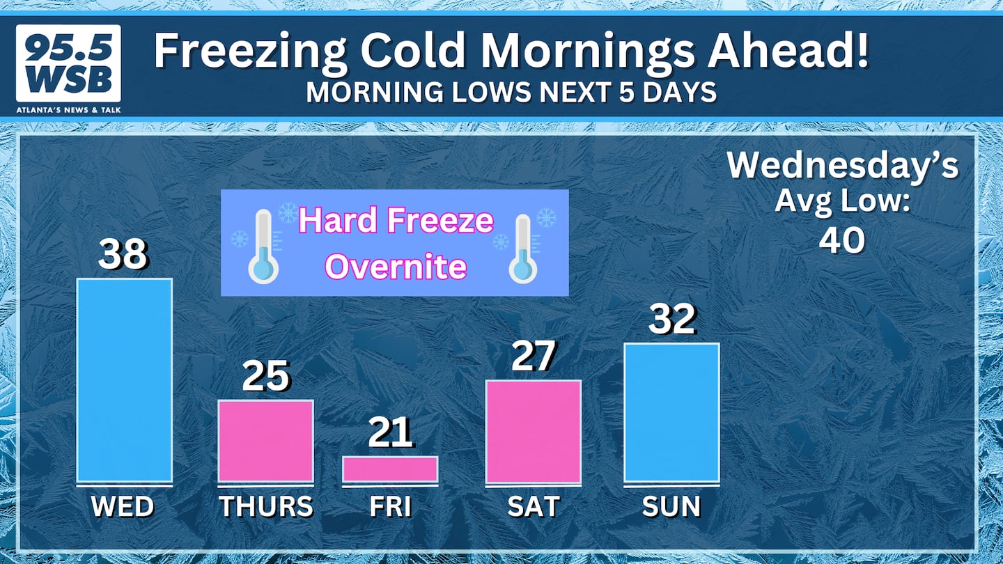
Behind the rain, temperatures will drop quickly into the mid 20s on Thursday morning! The animation below illustrates the Futurecast Hour-by-Hour temperatures from Wednesday afternoon into Thursday morning.
However, the coldest morning will be Friday, as temperatures bottom out to the upper 10s to low 20s -- remember, this is a hard freeze!
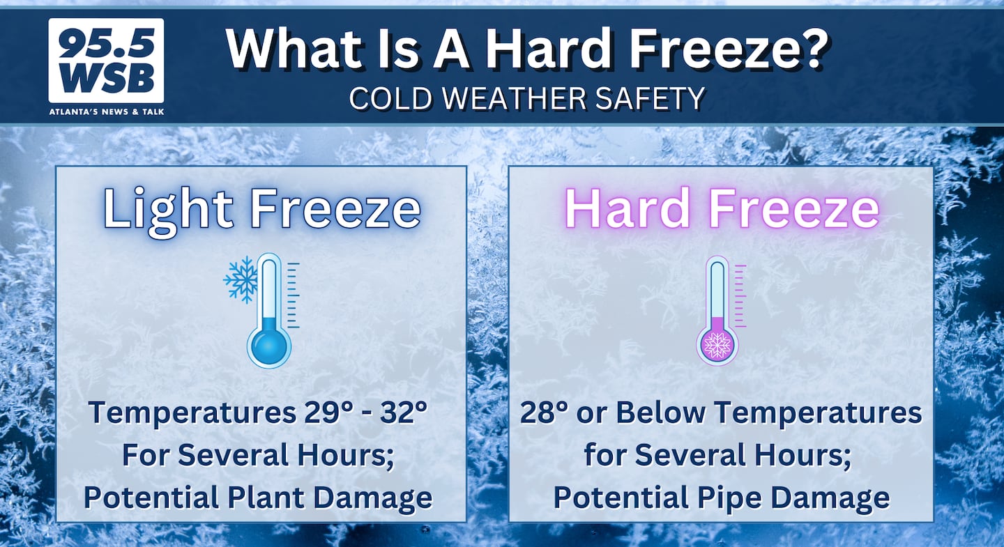
Another hard freeze is expected Saturday morning as temperatures drop to the low to mid 20s.
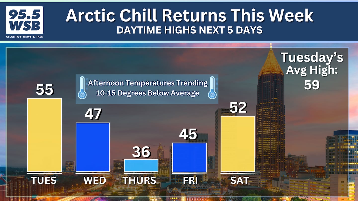
Afternoon temperatures will trend about 10 to 20 degrees below average on Thursday as daytime highs struggle to climb into the 30s.
Friday will trend a touch warmer with daytime highs in the mid 40s, but the true warm up will not take place until next week, when afternoon temperatures return to the 60s and 70s.
Share Your Temperature Reports With Me!
Facebook: Christina Edwards WSB
Instagram: ChristinaWSBwx
Twitter: @ChristinaWSBwx
TikTok: @ChristinaEdwards955WSB
©2025 Cox Media Group


 Sign Up

