
March is about to roll in like a lion as a storm system moves through the Southeast this week.
The Storm Prediction Center has identified a potential severe weather outbreak in the Deep South Tuesday as a low pressure system pushes a squall line through Texas, Louisiana, Arkansas, Mississippi, Alabama, Tennessee, and western Georgia. Damaging winds and a few tornadoes will be possible in the areas marked “Slight Risk” and “Enhanced Risk” below.
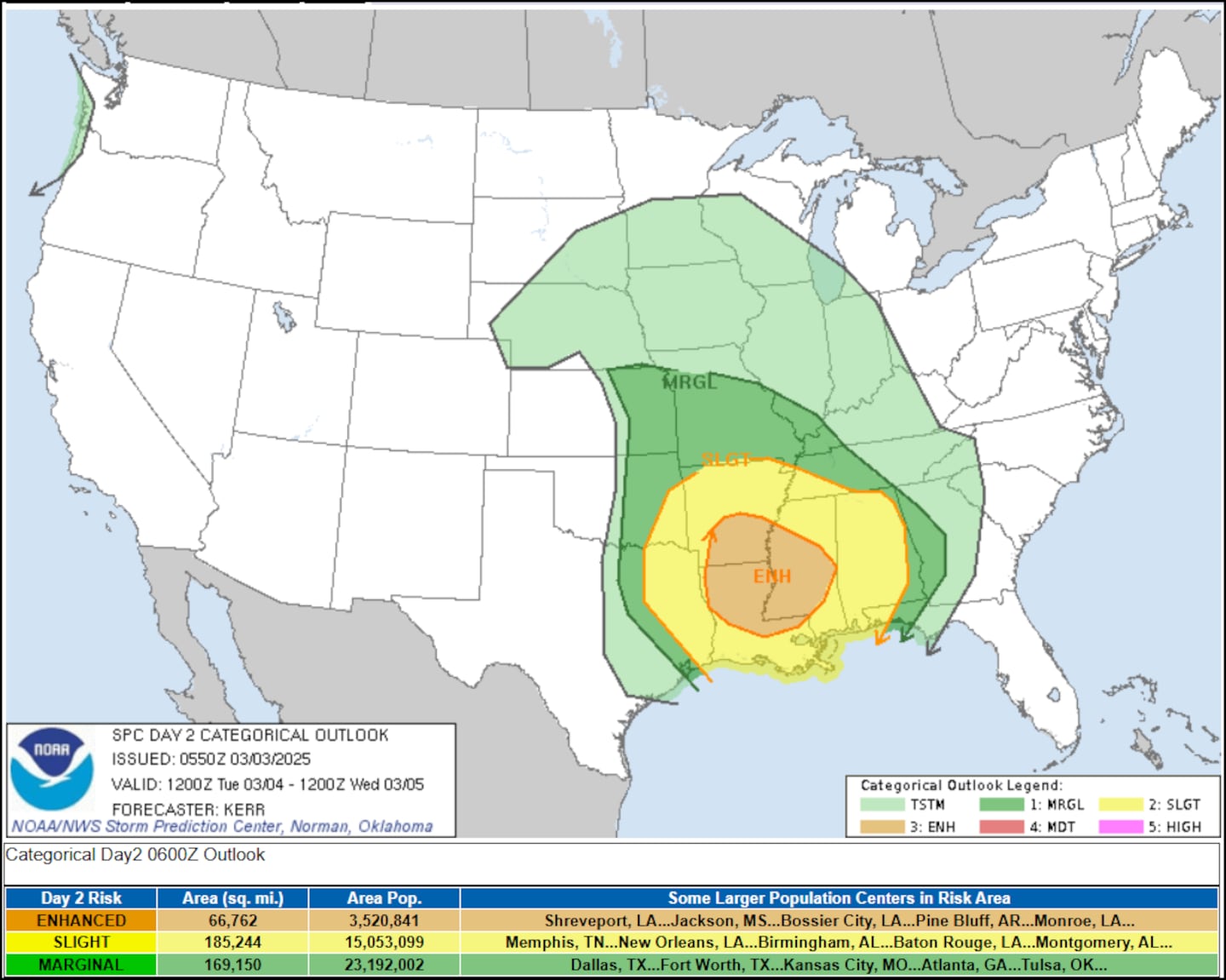
The severe weather threat diminishes as it approaches the Georgia/Alabama state line, however enough energy will be available for the squall line to produce damaging wind gusts throughout North Georgia.
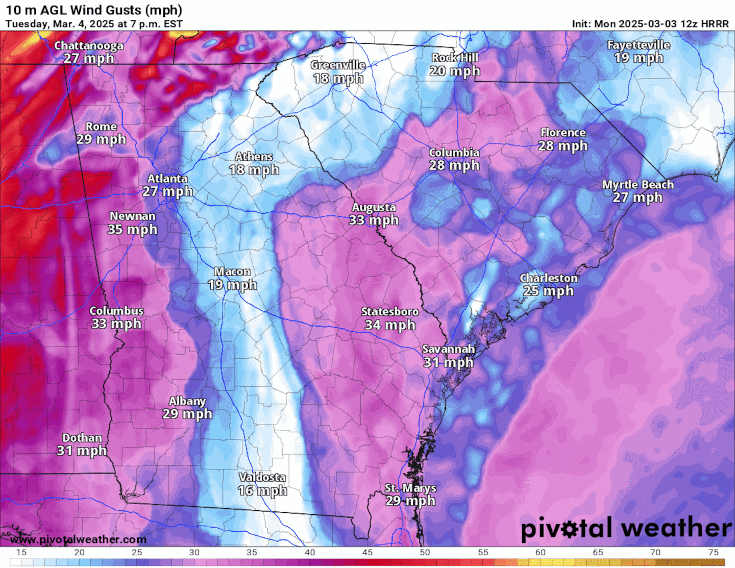
The squall line will move through North Georgia -- including Metro Atlanta -- between 10pm Tuesday and 6am Wednesday. The animation below illustrates the Futurecast wind gusts for this time frame, with gusts as high as 50 to 55 mph possible.
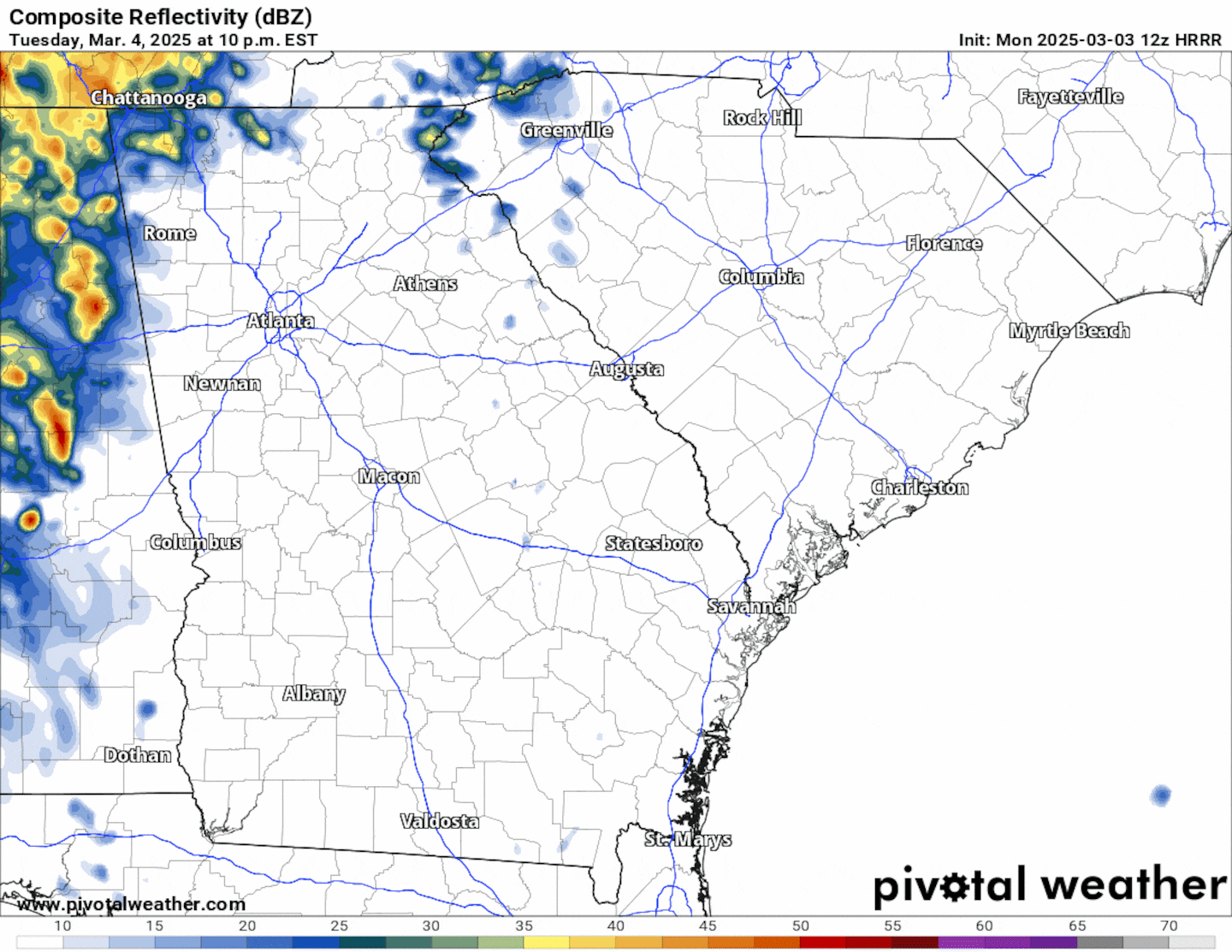
The animation below illustrates the Futurecast radar imagery for Tuesday night into Wednesday morning. As much as 1 inch of rainfall is possible as the squall line moves through.
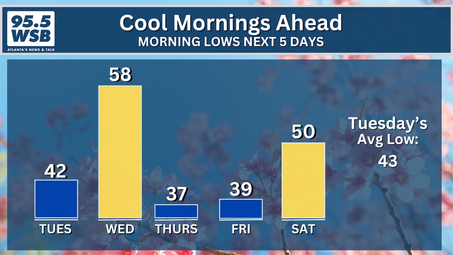
Temperature Roller Coaster This Week
Ahead of the storms, afternoon temperatures will climb into the low 60s on Monday afternoon, and they will swell into the low 70s by Tuesday afternoon.
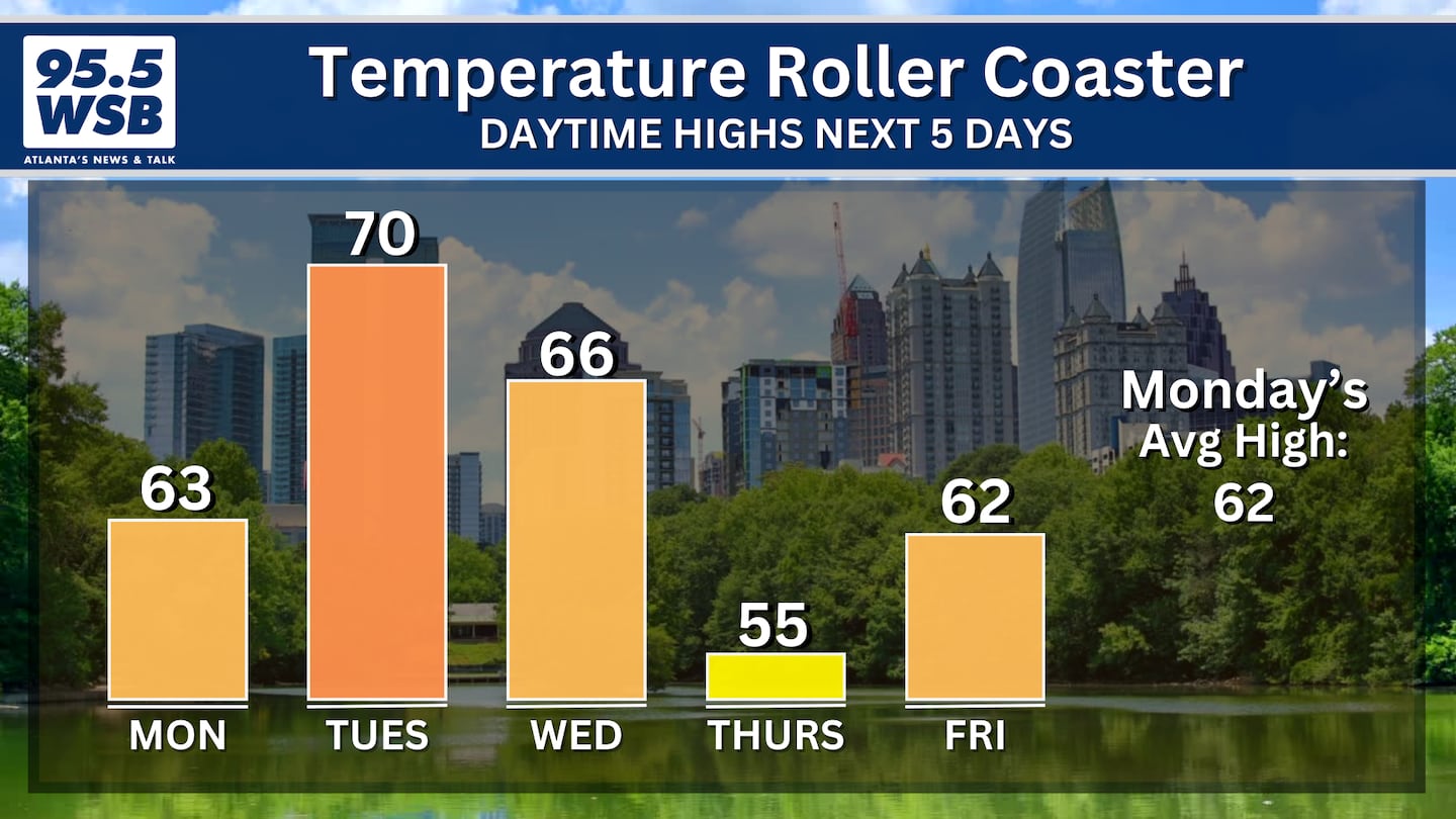
However, the storms are associated with a cold front that will cool afternoon temperatures into the mid 50s by Thursday.
Morning temperatures will also be impacted by the mid-week cold front. Sunrise temperatures will swell to the upper 50s on Wednesday morning, but they will drop into the 30s for the rest of this week.
Share Your Storm Reports With Me!
Facebook: Christina Edwards WSB
Instagram: ChristinaWSBwx
Twitter: @ChristinaWSBwx
TikTok: @ChristinaEdwards955WSB
©2025 Cox Media Group


 Sign Up

