We made it to the Weekend!
After a week featuring a chilly, pouring rain, it is wonderful to experience the sunshine today.
However -- clouds will return Saturday, and a line of strong to potentially severe storms will roll through again on Sunday.
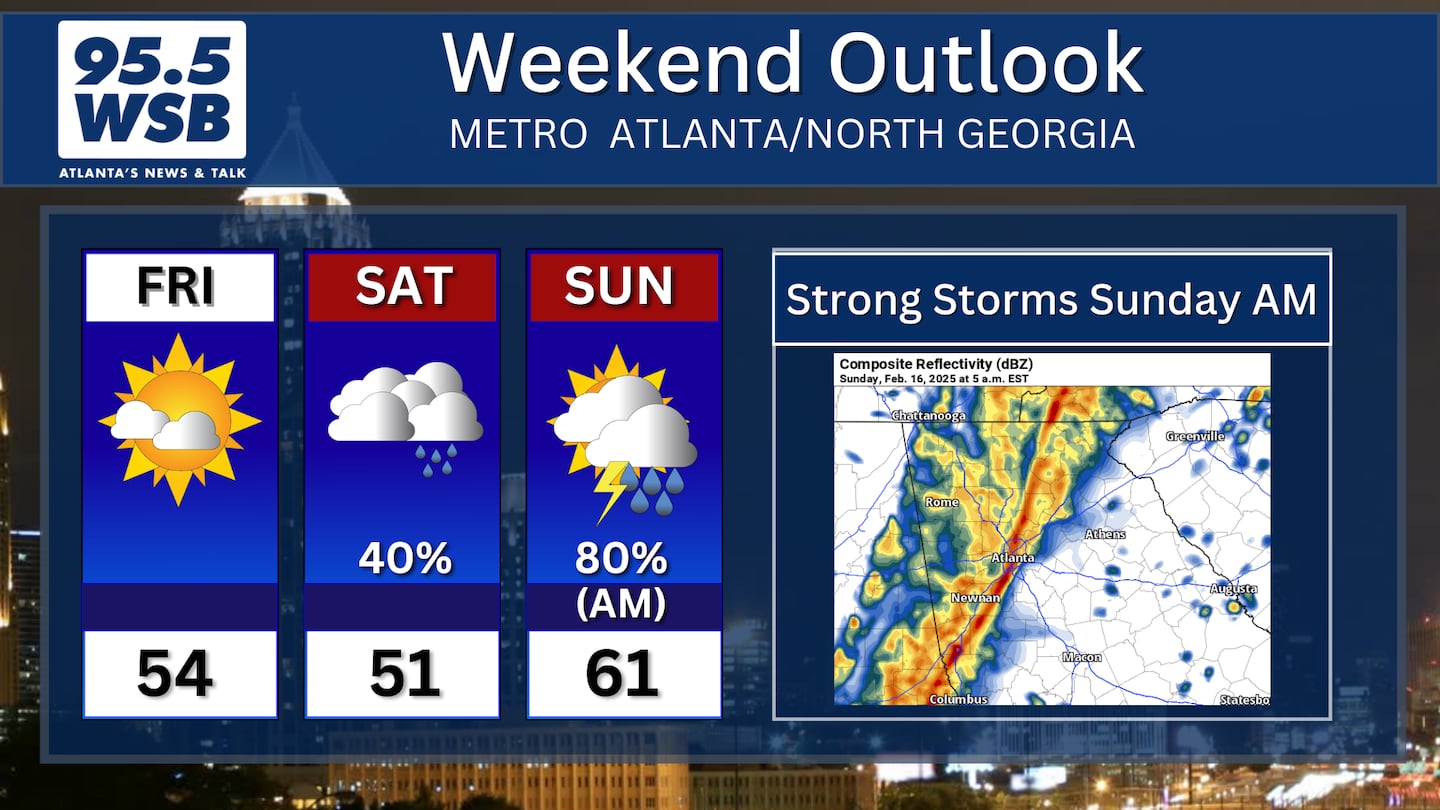
Saturday: Cloudy skies, light showers, drizzle
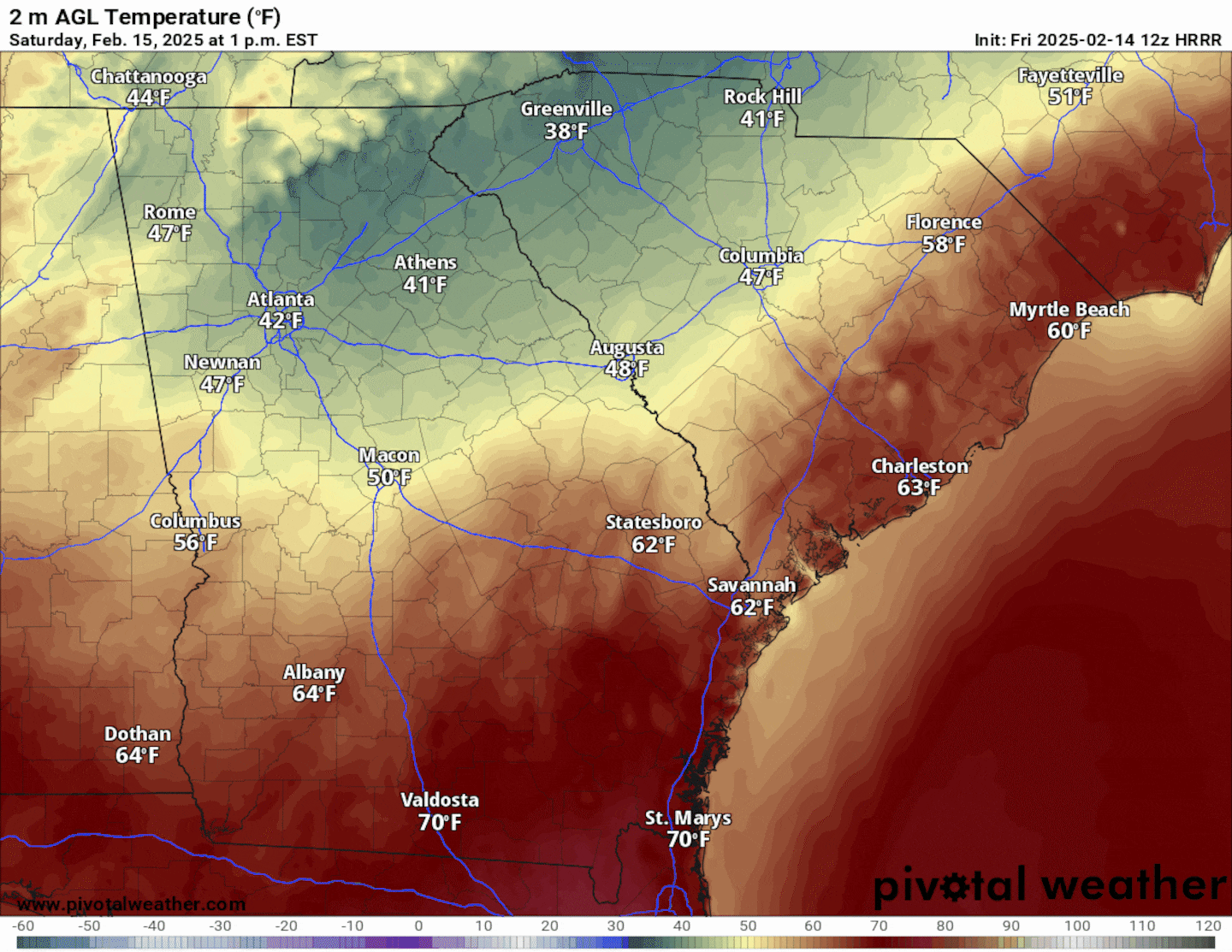
Clouds will return to the region late tonight into early Saturday morning, and another “wedge” will develop over North Georgia and Metro Atlanta.
“The Wedge” occurs when high pressure off the East Coast pushes cold air into the Appalachian Mountains. This cold air “wedges up” along the mountain chain and eventually pools in the Piedmont region of Metro Atlanta and North Georgia.
The Futurecast Temperature image below illustrates “The Wedge” of cold air along the I-85 corridor in North Georgia.

This cold, dense air is responsible for producing cloudy skies as well as drizzle and light rain. In addition, as the rain falls, it reinforces the cold air in place, often limiting highs to the 40s and low 50s.
However, there is potential that “The Wedge” will weaken, allowing warmer temperatures to move into the southern Metro Atlanta area late Saturday night into Sunday morning, ahead of our next line of rain showers and thunderstorms.
Sunday Morning: Tracking a Line of Strong to Potentially Severe Storms
The Storm Prediction Center has placed the western half of Metro Atlanta under a “Slight Risk” for severe thunderstorms for Sunday morning.
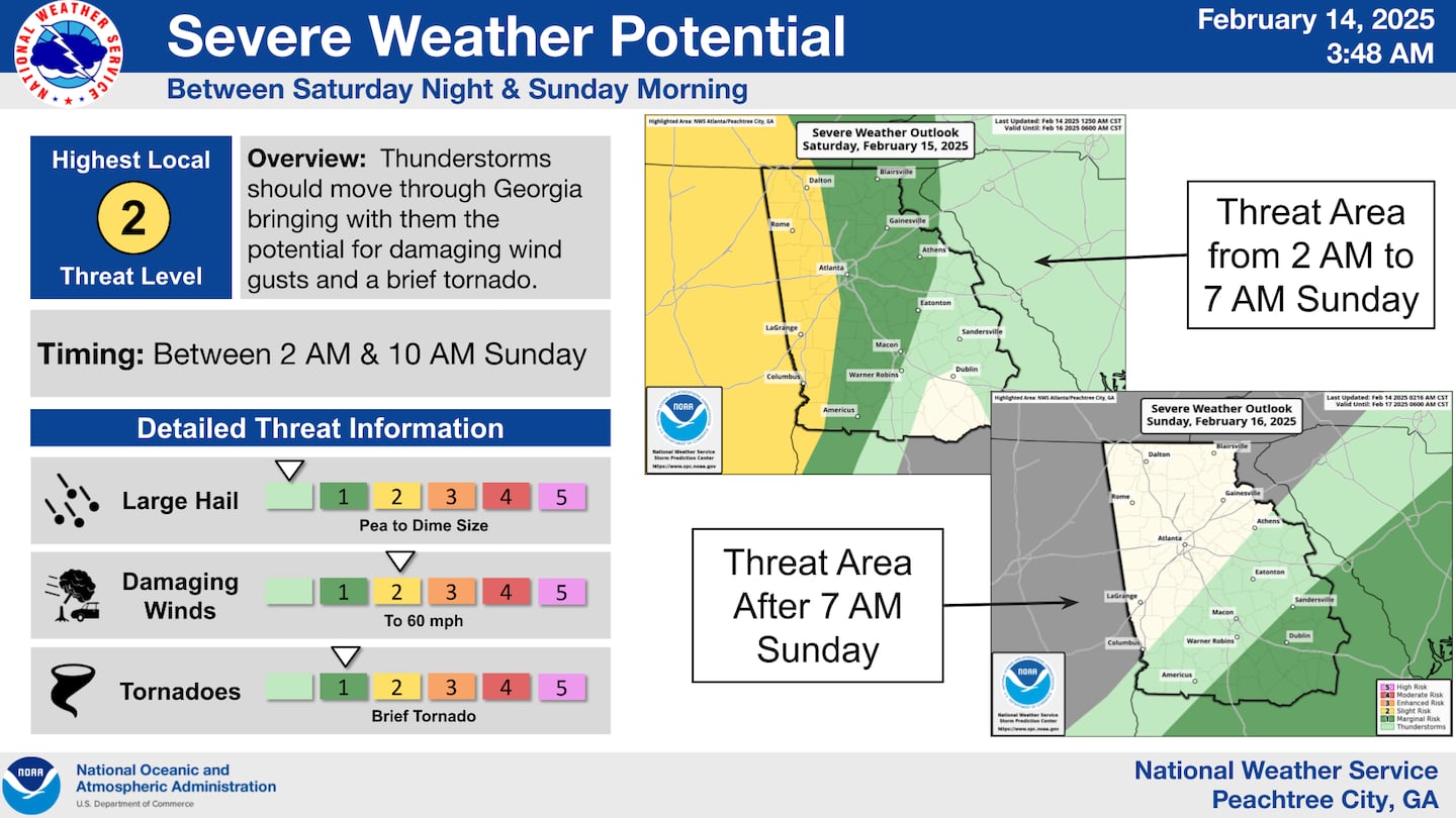
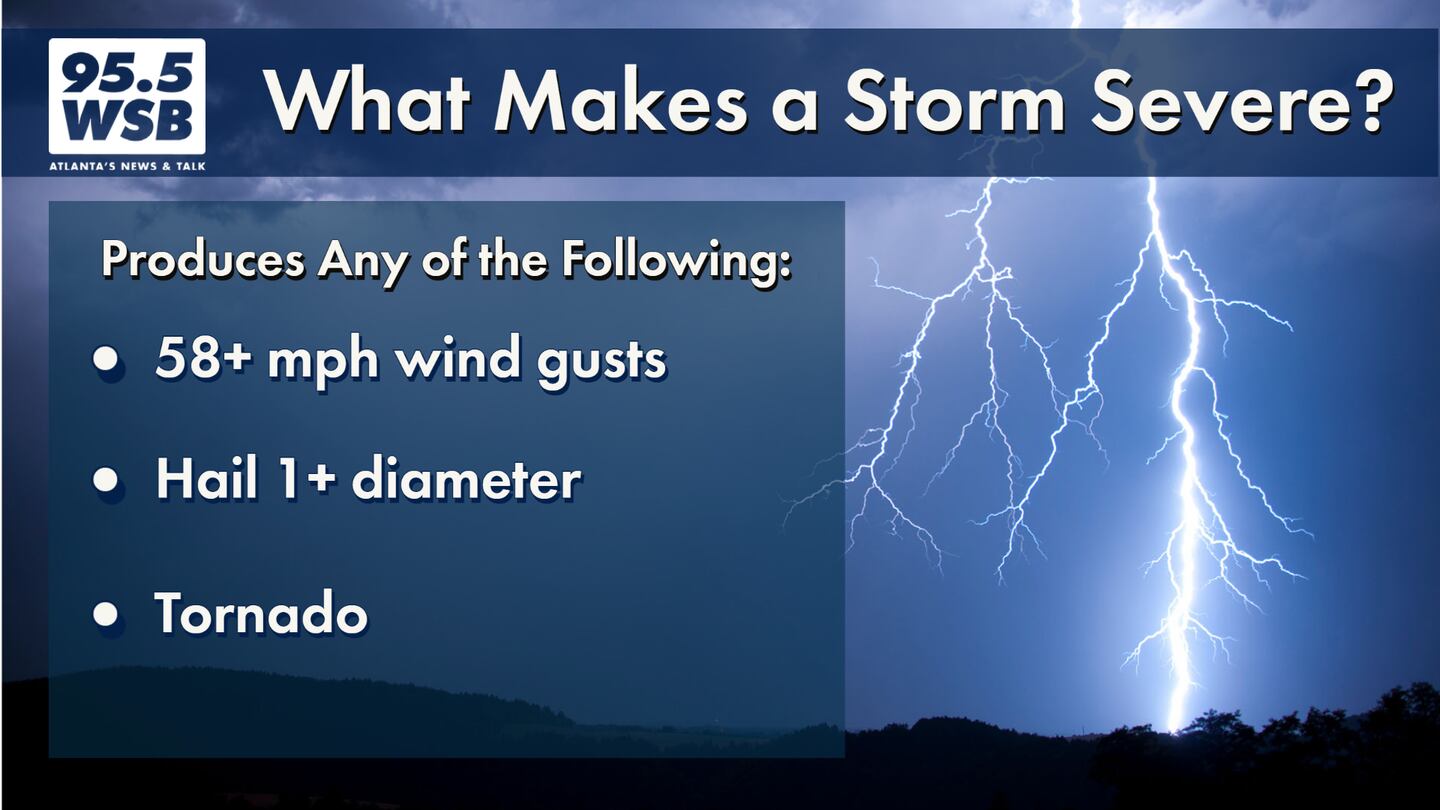
The main impact from these storms would be damaging wind gusts capable of knocking down trees and powerlines, though an isolated tornado cannot be ruled out as well.
For Metro Atlanta, the timeline for these storms is between 4am and 9am Sunday. The animation below illustrates the Futurecast Radar for Sunday morning.
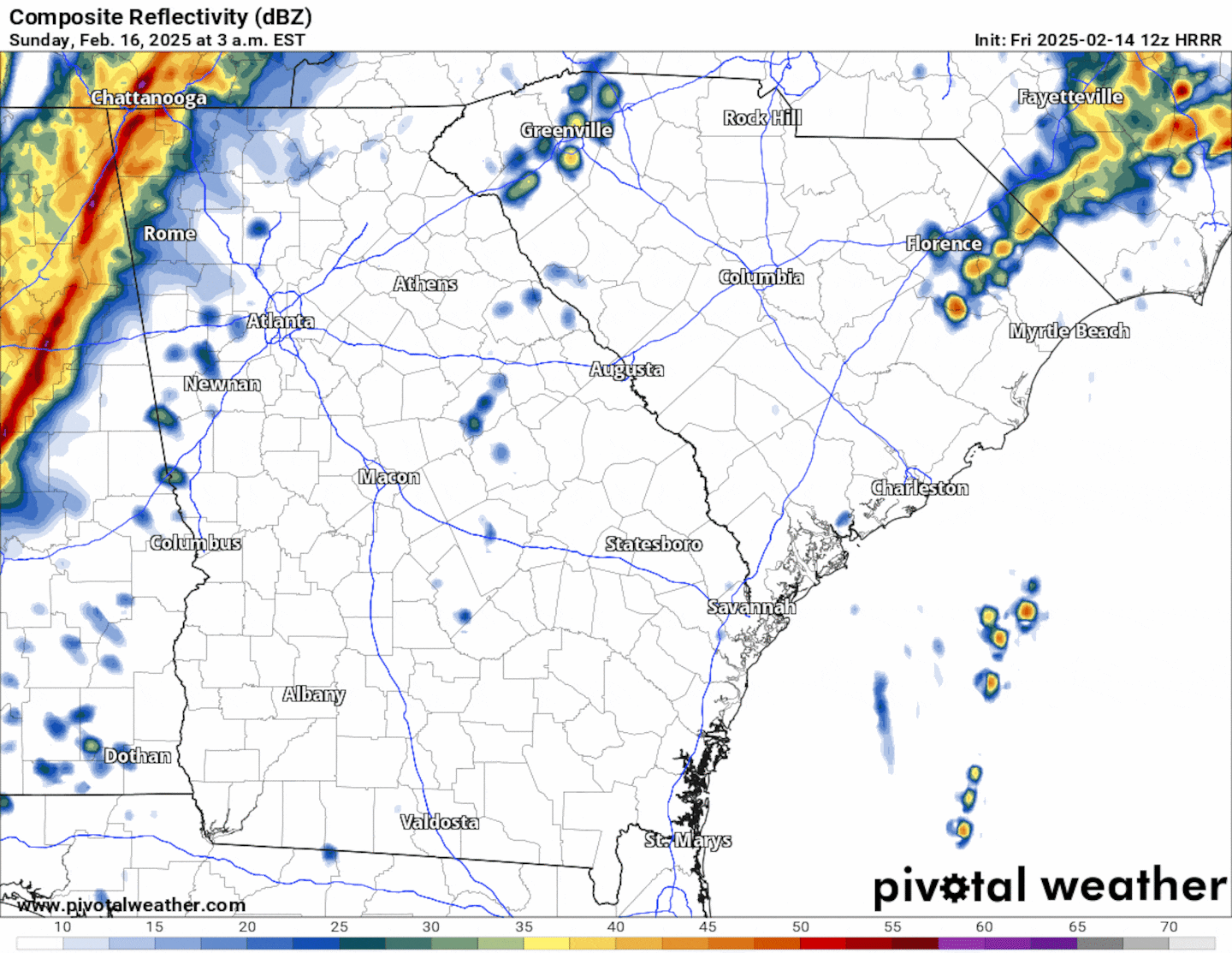
In addition to the damaging wind threat, these storms will be capable of producing an additional 1 to 2 inches of rainfall on top of the rain we endured earlier this week. Flash flooding may be a concern until the storms roll out of Metro Atlanta.
Drying out Sunday Afternoon, then turning chilly!
Clouds will linger Sunday afternoon as colder air moves into North Georgia. Dry conditions will prevail Monday, but temperatures will drop into the 30s Monday morning and stay in the 40s on Monday afternoon!
Share Your Storm Reports With Me!
Facebook: Christina Edwards WSB
Instagram: ChristinaWSBwx
Twitter: @ChristinaWSBwx
TikTok: @ChristinaEdwards955WSB
©2025 Cox Media Group


 Sign Up

