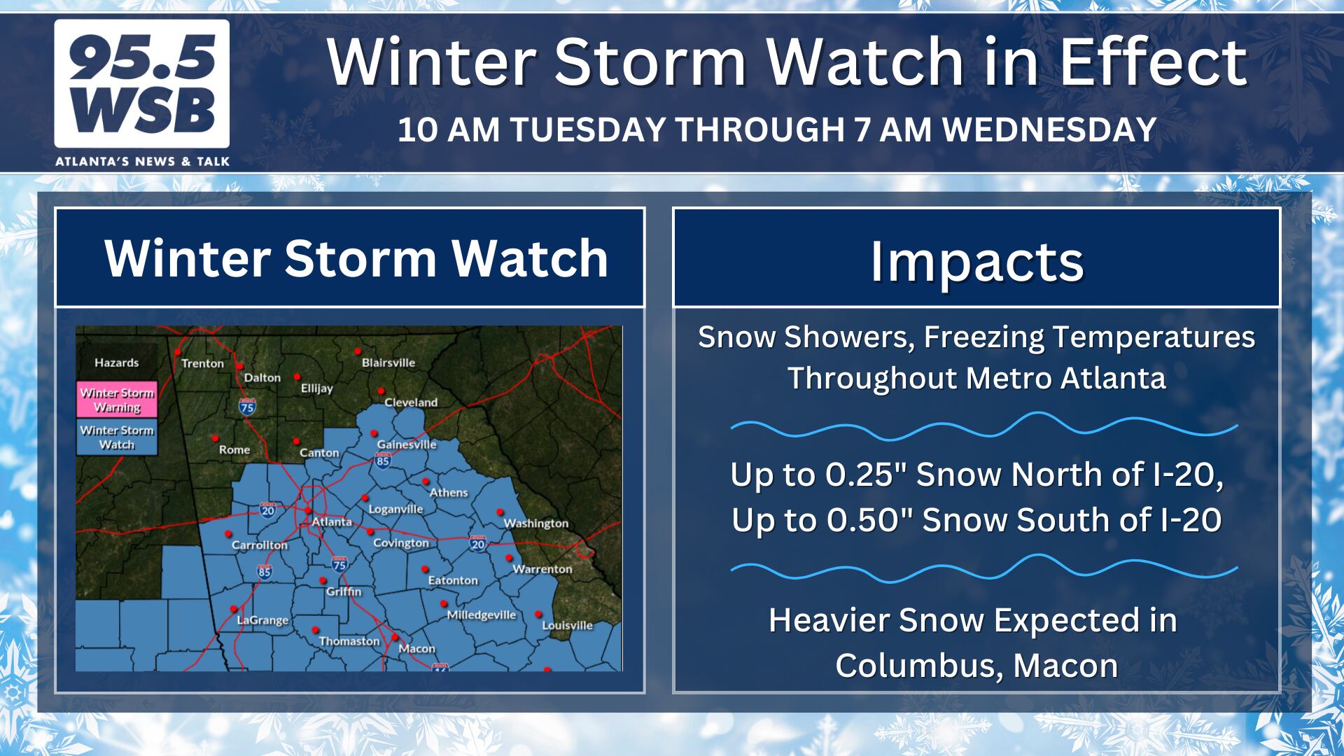
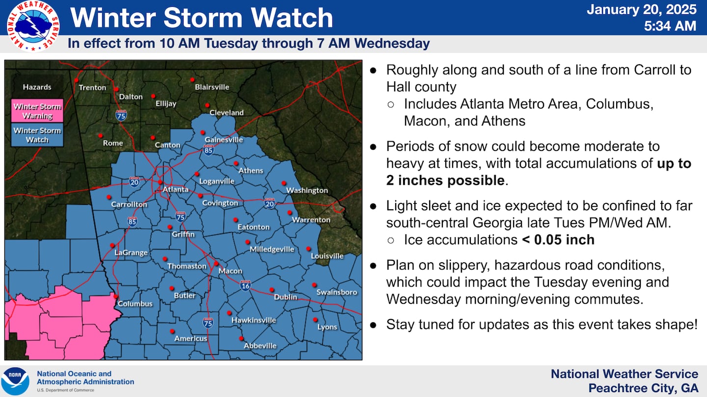
The National Weather Service in Peachtree City has issued a Winter Storm Watch for Metro Atlanta, which will go into effect beginning 10 am Tuesday and end at 7am Wednesday.
The National Weather Service issues a Winter Storm Watch when there is potential for significant and hazardous winter weather to affect the area within 48 hours.
With the potential winter storm arriving within the next 24 hours, the National Weather Service did note on Monday morning that a potential upgrade to a Winter Storm Advisory or Winter Storm Warning may be issued for portions of the state of Georgia sometime Monday afternoon.
For Metro Atlanta, snow showers will fall early Tuesday afternoon and continue through Tuesday evening. Due to the prolonged freezing conditions, any snow that falls is expected to stick and accumulate through the afternoon.
Snow Accumulations Increase Further South
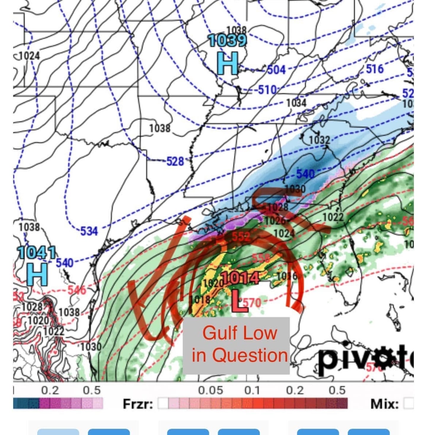
There are two things to note regarding this winter storm compared to the event just a few weeks ago on January 10, 2025:
- A frozen air mass will be in place for all of Metro Atlanta, with very cold and very dry air supporting all snow showers for the Metro Region
- The Gulf Low will track further south compared to the previous event, so higher snowfall totals will occur in South and Central Georgia; lower snow totals will taper further north, with potentially little to no snow for the North Georgia Mountains
How Much Snow?
Due to the more southerly track of the low, higher snowfall will occur in Columbus and Macon, but the snowfall will taper further north into the Georgia Mountains.
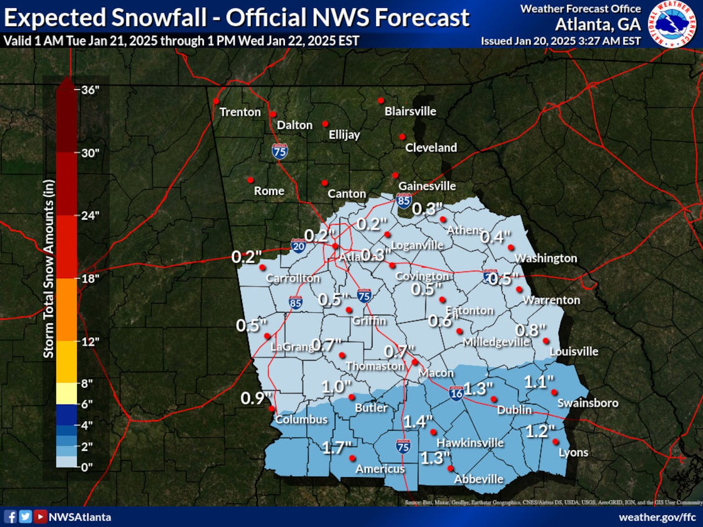
As a result, the snowfall totals will have a sharp gradient over Metro Atlanta.
The Northern Suburbs can expect a dusting to up to 0.5″ of snow.
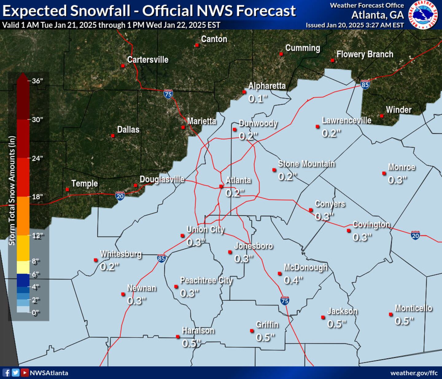
Expect 0.5″ to 1″ of snow in the Southern Suburbs, with higher snowfall totals closer to Macon.
Big Caveat: If More Atmospheric Moisture Arrives, then More Snowfall Possible
Tuesday’s set up is giving many meteorologists in Metro Atlanta flashbacks to 2014:
- In 2014, air and surface temperatures were already at or below freezing for several hours
- In 2014, models consistently indicated that snow showers would be focused near Macon and areas south, and no snow was expected for the Metro Atlanta area
- In 2014, snow showers falling the morning of Snowmageddon indicated that more moisture was available in the atmosphere than indicated by model data, thereby producing higher and more widespread snowfall compared to what was advertised just 24 hours prior by the models.
All this to say, even with a small amount of snowfall in the forecast, it is important to stay weather aware and prudent with travel decisions Tuesday afternoon and Tuesday evening.
This is a fluid situation, please continue to monitor the forecast through Tuesday evening.
Share Your Frozen Precipitation Reports With Me!
Facebook: Christina Edwards WSB
Instagram: ChristinaWSBwx
Twitter: @ChristinaWSBwx
TikTok: @ChristinaEdwards955WSB
©2025 Cox Media Group


 Sign Up

